
Notice of Meeting:
I hereby give notice that an ordinary meeting of the
Strategy, Planning & Engagement Committee will be held on:
Date: Tuesday
20 August 2024
Time: 10:00am
Venue: Council
Chambers, Dunedin Public Art Gallery, The Octagon, Dunedin
Sandy Graham
Strategy, Planning & Engagement Committee
PUBLIC AGENDA
|
Chairperson
|
Cr Sophie Barker
|
|
|
Deputy Chairperson
|
Cr Kevin Gilbert
|
|
|
Members
|
Cr Bill Acklin
|
Cr David Benson-Pope
|
|
|
Mr Matapura Ellison
|
Cr Christine Garey
|
|
|
Cr Carmen Houlahan
|
Cr Marie Laufiso
|
|
|
Cr Cherry Lucas
|
Cr Mandy Mayhem
|
|
|
Cr Jim O'Malley
|
Ms Megan Potiki
|
|
|
Mayor Jules Radich
|
Cr Lee Vandervis
|
|
|
Cr Steve Walker
|
Cr Brent Weatherall
|
|
|
Cr Andrew Whiley
|
|
Senior Officer Nicola
Morand, Manahautū (General Manager Māori Partnerships and Policy)
Governance Support Officer Wendy
Collard
Wendy Collard
Governance Support Officer
Telephone: 03 477 4000
governance.support@dcc.govt.nz
www.dunedin.govt.nz
Note: Reports
and recommendations contained in this agenda are not to be considered as
Council policy until adopted.
|

|
Strategy, Planning &
Engagement Committee
20 August 2024
|
ITEM TABLE OF CONTENTS PAGE
1 Karkia
Timatanga 4
2 Public
Forum 4
3 Apologies 4
4 Confirmation
of Agenda 4
5 Declaration
of Interest 5
6 Confirmation
of Minutes 16
6.1 Strategy, Planning
& Engagement Committee meeting - 19 June 2024 16
Part
A Reports (Committee has power to decide these matters)
7 Strategy,
Planning and Engagement Committee Forward Work Programme 24
8 DCC
Submission on New Zealand’s second emissions reduction plan 33
9 Initiation
of Multi-unit Development and Heritage Plan Change to the 2GP 169
10 Notice
of Intent- Town Belt Reserve Management Plan Draft 175
11 Notice
of Intent - Otago Harbour Reserves Management Plan Draft 309
12 Items
for Consideration by the Chair 467
13 Karakia
Whakamutunga
The meeting will close with a
Karakia Whakamutunga.
|

|
Strategy, Planning &
Engagement Committee
20 August 2024
|
1 karakia timatanga
The meeting will open
the meeting with a Karakia Timatanga.
2 Public
Forum
At the close of the agenda no
requests for public forum had been received.
3 Apologies
An apology has been received from
Cr Steve Walker.
That the Committee:
Accepts the apology from Cr
Steve Walker.
4 Confirmation
of agenda
Note:
Any additions must be approved by resolution with an explanation as to why they
cannot be delayed until a future meeting.
|

|
Strategy, Planning & Engagement
Committee
20 August 2024
|
Declaration of Interest
EXECUTIVE SUMMARY
1. Members
are reminded of the need to stand aside from decision-making when a conflict
arises between their role as an elected representative and any private or other
external interest they might have.
2. Elected
members are reminded to update their register of interests as
soon as practicable, including amending the register at this meeting if
necessary.
RECOMMENDATIONS
That the Committee:
a) Notes/Amends if
necessary the Elected Members' Interest Register attached as Attachment A; and
b) Confirms/Amends the
proposed management plan for Elected Members' Interests.
Attachments
|
|
Title
|
Page
|
|
⇩a
|
Register of Interest
|
6
|
|

|
Strategy, Planning & Engagement
Committee
20 August 2024
|


|

|
Strategy, Planning & Engagement Committee
20 August 2024
|
Confirmation
of Minutes
Strategy,
Planning & Engagement Committee meeting - 19 June 2024
RECOMMENDATIONS
That the Committee:
a) Confirms the public
part of the minutes of the Strategy, Planning & Engagement Committee
meeting held on 19 June 2024 as a correct record.
Attachments
|
|
Title
|
Page
|
|
A⇩
|
Minutes of Strategy,
Planning & Engagement Committee meeting held on 19 June 2024
|
17
|
|

|
Strategy,
Planning & Engagement Committee
20 August 2024
|

Strategy, Planning & Engagement Committee
MINUTES
Minutes of an ordinary
meeting of the Strategy, Planning & Engagement Committee held in the
Council Chambers, Dunedin Public Art Gallery, The Octagon, Dunedin on Wednesday
19 June 2024, commencing at 10:14 am
PRESENT
|
Chairperson
|
Cr Sophie Barker
|
|
|
Deputy Chairperson
|
Cr Kevin Gilbert
|
|
|
Members
|
Cr David Benson-Pope
|
Mr Matapura Ellison
|
|
|
Cr Christine Garey
|
Cr Carmen Houlahan
|
|
|
Cr Cherry Lucas
|
Cr Mandy Mayhem
|
|
|
Cr Jim O'Malley
|
Cr Lee Vandervis
|
|
|
Cr Steve Walker
|
Cr Brent Weatherall
|
|
|
Cr Andrew Whiley
|
|
|
IN ATTENDANCE
|
Nicola Morand (Manahautū - General Manager Policy
and Partnerships), David Ward (General Manager 3 Waters and Transition), Gina
Hu’akau (Community
Partnerships Manager), Jeanette Wikaira (General Manager, Arts, Culture
and Recreation , Scott MacLean (General Manager, Climate and City Growth), Dr
Anna Johnson (City Development Manager), Nadia Wesley-Smith (Corporate Policy
Manager), Junichi Sugishita (Senior Policy
Analyst, Corporate Policy), Florence Reynolds (Manager – Zero Carbon),
Elizabeth Schowald (Senior Parks and Recreation Planner), Ken Tipa (Poa Arahi – Māori Cultural Capacity Manager),
Jonathan Rowe (Programme Manager – South Dunedin Future), Emma
Christmas (Senior Planner, City Development), Jane MacLeod (Team Leader,
Planning – City Development), Mark
Mawdsley (Team
Leader Advisory Services, City Development)
and Clare Sullivan (Manager Governance)
|
Governance Support Officer Wendy
Collard
1 Opening
Cr Barker opened the meeting with a Karakia Timatanga.
2 Public
Forum
There was no Public Forum.
|
3 Apologies
|
|
|
Moved (Cr Sophie Barker/Cr Kevin Gilbert):
That the Committee:
Accepts the apologies
from Ms Megan Potiki, Crs Bill Acklin, Marie Laufiso and Mayor Jules Radich
(for absence) and Cr Christine Garey (for early departure)
Motion
carried (SPECC/2024/019)
|
|
4 Confirmation
of agenda
|
|
|
Moved (Cr Sophie Barker/Cr Kevin Gilbert):
That the Committee:
Confirms the agenda with
the following alteration
That Item 11 –
Sustainability Framework – City Portrait and United Nations
Sustainability Development Goals Update Report be withdrawn.
Motion
carried (SPECC/2024/020) with Matapura Ellison abstaining
|
5 Declarations
of interest
Members were
reminded of the need to stand aside from decision-making when a conflict arose
between their role as an elected representative and any private or other
external interest they might have.
|
|
Moved (Cr Sophie Barker/Cr Kevin Gilbert):
That the Committee:
a) Notes the Elected Members' Interest Register attached as; and
b) Confirms the proposed management plan for
Elected Members' Interests.
Motion
carried (SPECC/2024/021)
|
6 Confirmation
of Minutes
|
6.1 Strategy,
Planning & Engagement Committee meeting - 24 April 2024
|
|
|
Moved (Cr Kevin Gilbert/Cr Steve Walker):
That the Committee:
a) Confirms the minutes of the Strategy, Planning
& Engagement Committee meeting held on 24 April 2024 as a correct record.
Motion
carried (SPECC/2024/022)
|
Part
A Reports
|
7 Strategy,
Planning and Engagement Committee Forward Work Programme
|
|
|
A report
from Civic provided a regular update of the Strategy, Planning and Engagement
Committee forward work programme showing areas of activity, progress and
expected timeframes for decision making across a range of areas of work .
|
|
|
The Manahautū
- General Manager Policy and Partnerships (Nicola Morand), the Climate and
City Growth General Manager (Scott MacLean), City Development Manager (Dr
Anna Johnson) and the Programme Manager – South Dunedin Future (Jonathan Rowe) responded to questions.
|
|
|
Moved (Cr Sophie Barker/Cr Kevin Gilbert):
That the Committee:
a) Notes the Strategy, Planning and Engagement Committee
forward work programme.
Motion
carried (SPECC/2024/023)
|
|
8 Strategy,
Planning and Engagement Committee Activity Report
|
|
|
A report from Policy provided
an update on progress towards projects, plans and strategies that sit within
the forward work programme of the Strategy, Planning and Engagement Committee
for the period ending May 2024.
Cr Whiley entered the meeting at 10.39 am
|
|
|
The Manahautū General Manager Māori Partnerships
and Policy (Nicola Morand), Zero Carbon Manager (Florence Reynolds), Poa
Arahi – Māori Cultural Capacity Manager (Ken Tipa), Senior Parks
and Recreation Planner (Elizabeth Schowald) responded to questions.
|
|
|
Moved (Cr Sophie Barker/Cr Kevin
Gilbert):
That the Committee:
a) Notes the updates of activities.
.Motion carried (SPECC/2024/024)
|
|
9 Proposed
Governance Approach to Strategies, Plans and Programmes of Work
|
|
|
A report from Corporate
Policy advised that Council had a range of strategies, plans and programme of
work that required governance oversight. The proposed approach clarified
decision-making and reporting requirements related to governance oversight
and sought approval to recommend that Council adopt the update.
|
|
|
The Manahautū
- General Manager Policy and Partnerships (Nicola Morand), Community
Partnerships Manager (Gina Hu’akau) and Senior Policy Analyst,
Corporate Policy (Junichi Sugishita) responded to questions.
|
|
|
Moved (Cr Sophie Barker/Matapura Ellison):
That the Committee:
a) Approves the proposed governance approach.
Motion
carried (SPECC/2024/025) with Cr Vandervis recording his vote against
|
|
|
Moved (Cr Sophie Barker/Cr Kevin Gilbert):
That the Committee:
b) Recommends Council adopts the proposed amendments to the wording and template in
relation to Councillor Advisory Panels in the Committee Structure and
Delegations Manual.
c) Notes that, if approved by Council, the amended Terms of Reference
template will be used for all future Advisory Panels, including:
i) the four wellbeing strategies (Ara Toi,
Economic Development Strategy, Social Wellbeing Strategy, Te Ao Tūroa)
ii) the Zero Carbon Plan
iii) the Heritage Action Plan
iv) the Dunedin Destination Management Plan
v) the Ōtepoti Live Music Action Plan.
Motion
carried (SPECC/2024/026) with Cr Vandervis recording his vote against
|
|
10 Strategic
Refresh Advisory Panel - Quarterly Update Report
|
|
|
A report from Corporate
Policy provided an update on the Strategy, Planning and Engagement
Committee’s forward workplan, activity undertaken by the Strategic
Refresh Advisory Panel and outlined the next steps.
|
|
|
The Manahautū
- General Manager Policy and Partnerships (Nicola Morand) and Community
Partnerships Manager (Gina Hu’akau) spoke to the report and responded
to questions.
|
|
|
Moved (Cr Cherry Lucas/Cr Kevin Gilbert):
That the Committee:
a) Notes the Strategic Refresh Advisory Panel –
Quarterly Update Report
Motion
carried (SPECC/2024/027) with Cr Vandervis recording his vote against
|
|
12 District
Plan work programme update report
|
|
|
A report from City
Development provided an update on progress on the Second Generation District
Plan (2GP) work programme including an update on appeals to the 2GP and
Variation 2, progress on the Minor Improvements plan change (‘Variation
3’), which was initiated in November 2021, and the proposed timing for
making the 2GP partially operative.
The report also provided an
outline of proposed future plan changes and their approximate timing and
sought approval to send a letter to the Minister for the Environment to
request the Government suspend the requirement for the Dunedin City Council
to implement the National Planning Standards by May 2026.
|
|
|
The General Manager, 3 Waters and Transition (David Ward),
the City Development Manager (Dr Anna Johnson) and the Senior Planner, City
Development (Emma Christmas) spoke to the report and responded to questions.
Cr Carmen Houlahan left the meeting at 11:09 am and
returned at 11:12 am.
Cr Mandy Mayhem left the meeting at 11:12 and returned at
11:16 am during debate.
|
|
|
Moved (Cr Jim O'Malley/Cr Cherry Lucas):
That the Committee:
a) Notes the District Plan Work Programme update report.
b) Approves letters, with any amendments, to be sent
to the Minister for the Environment and the Minister for Resource Management
Reform in relation to implementation of the National Planning Standards May
2026.
c) Authorises the Chief Executive to make any minor
editorial changes to the letter if required.
Motion
carried (SPECC/2024/028)
|
|
13 Heritage
Action Plan Update
|
|
|
A report from City
Development provided an update on the Heritage Action Plan. It
highlighted aspects of the draft Implementation Plan to be progressed and to
be included as part of the 2025-34 9-year plan.
|
|
|
The General Manager, 3 Waters and Transition (David Ward)
and City Development Manager (Dr Anna Johnson) and Team Leader Advisory
Services, City Development (Mark Mawdsley) spoke to the report and responded
to questions.
|
|
|
Moved (Cr Sophie Barker/Cr David Benson-Pope):
That the Committee:
a) Notes the Heritage Action
Plan Update report
.Motion
carried (SPECC/2024/029)
|
Cr Andrew Whiley left meeting at 11.40 am.
|
15 Karakia
Whakamutunga
|
|
|
The meeting closed with a
Karakia Whakamutunga.
|
The meeting concluded at 11.45 am.
..............................................
CHAIRPERSON
|

|
Strategy, Planning & Engagement
Committee
20 August 2024
|
Part
A Reports
Strategy, Planning and Engagement Committee Forward Work
Programme
Department: Civic
EXECUTIVE SUMMARY
1 The
purpose of this report is to provide a regular update of the Strategy, Planning
and Engagement Committee forward work programme to show areas of activity,
progress and expected timeframes fir decision making across a range of areas of
work (Attachment A).
2 As
this is an administrative report only, there are no options or Summary of
Considerations.
RECOMMENDATIONS
That the Committee:
a) Notes the Strategy,
Planning and Engagement Committee forward work programme as shown in Attachment
A.
DISCUSSION
3 The
forward work programme will be a regular agenda item which shows areas of
activity, progress and expected timeframes for decision making across a range
of areas of work.
4 As
an update report, purple highlights show changes to timeframes. New items
added to the schedule will be highlighted in yellow. Items that have been
completed or updated are shown as bold.
Signatories
|
Author:
|
Wendy Collard - Governance Support Officer
|
|
Authoriser:
|
Nicola Morand - Manahautū (General Manager Māori
Partnerships and Policy)
|
Attachments
|
|
Title
|
Page
|
|
⇩a
|
Forward Work Programme
|
25
|
|

|
Strategy, Planning & Engagement
Committee
20 August 2024
|


|

|
Strategy, Planning & Engagement
Committee
20 August 2024
|
DCC Submission on New Zealand’s second emissions
reduction plan
Department: Sustainability Group
EXECUTIVE SUMMARY
1 This
report seeks approval of a draft Dunedin City Council (DCC) submission
(Attachment A) to the Ministry for the Environment (MfE) on New Zealand’s
draft second emissions reduction plan discussion document (the ERP2). The
consultation document is attached as Attachment B.
2 MfE
is seeking feedback on a discussion document about New Zealand’s second
emissions reduction plan. The draft DCC submission addresses:
a) DCC’s
climate response and approach
b) Advocating
for additional government interventions and support for community-level climate
response
c) Advocating
for leadership and equity in policies to reduce emissions.
RECOMMENDATIONS
That the Committee:
a) Approves the draft DCC
submission, with any amendments, on New Zealand’s second emissions
reduction plan discussion document.
b) Authorises the Chief
Executive to make any minor editorial changes to the submission if required.
BACKGROUND
3 The
Climate Change Response Act requires the government to publish emissions
reduction plans consistent with meeting the next five-year emissions budget on
a path to meeting long-term targets.
4 The
MfE has published a discussion document on the second emissions reduction plan
discussion document (ERP2) for consultation. Consultation closes on 21 August.
5 The
final ERP2 is required to be published by the end of 2024. It is the main tool
of the Government Climate Strategy published in July 2024.
6 The
discussion document contains the Government’s plans for the second
emissions budget period (2026-2030) and proposed amendments to the first
emissions reduction plan for the remainder of 2022-2025.
7 This
consultation outlines how emissions pricing, and the New Zealand Emissions
Trading Scheme in particular, will play a central role in government’s
climate change response. It includes policy proposals that sit across the
Government’s five priority areas of its climate strategy and focusses on
key sectors: energy, transport, agriculture, forestry and waste.
8 The
document also outlines seven key policies which the Government believes will
have the greatest impact on reducing emissions, alongside other actions in each
sector:
· Increasing
renewable energy by reducing the consenting burden through Electrify
NZ
· Targeting
10,000 public EV chargers by 2030
· Lowering
agricultural emissions by giving farmers the tools to reduce emissions and
through fair and sustainable pricing of on-farm agricultural emissions by
2030
· Investing
in resource recovery through the Waste Minimisation Fund
· Improving
organic waste and landfill gas capture
· Improving
public transport
· Investigating
carbon capture, utilisation and storage (CCUS).
DISCUSSION
9 The
DCC draft submission provides contextual information relating to the
DCC’s climate change mitigation targets and the Zero Carbon Plan.
10 The
Government’s proposed plan reduces the level of ambition on emissions
reduction compared with previous plans and projects a failure to meet the
2030-2035 emissions budget and 2050 target without significant offsetting. The
Climate Change Commission have stated that the Government’s approach,
which relies heavily on forestry sequestration, risks the first (to 2025) or
second (to 2030) emissions budgets not being achieved, due to fluctuations in
forestry harvests.
11 The draft
DCC submission asks that the Government use the measures available to them to
enable gross emissions reduction and meet its long-term targets enshrined in
legislation and set out in international agreements. The submission notes a
concern that government not taking sufficient action will lead to additional
costs for communities, local government, businesses, and exporters.
12 The
submission provides feedback on the Government’s proposals and seeks
further opportunities for the DCC to provide input into the proposals which are
still in development, such as the Electrify NZ programme.
13 The
submission notes that government action should be undertaken alongside the
Emissions Trading Scheme to ensure a coherent approach to emissions reduction
that also considers adaptation. The submission advocates for transport
investment in reducing emissions such as by improvements in walking and cycling
safety and public transport. Government transport funding has been redirected
toward roads in the North Island.
14 The
submission asks the Government to support and enable community level climate
action and notes the DCC welcomes partnership opportunities with Government to
pilot interventions and make faster progress towards local emissions reduction
targets.
OPTIONS
Option One – Recommended Option – Approve the
draft submission
15 Under this
option, the Committee approves the draft DCC submission – with any
amendments – to the MfE on the second emissions reduction plan discussion
document.
Advantages
· Enables
the DCC to provide input into the Government’s proposals that could bring
significant changes to climate mitigation legislation and potential impacts on
the ability for the DCC to reach its climate mitigation interventions and goals
under the Zero Carbon Plan.
· Enables
the DCC to advocate for more urgent action on climate change, in line with the
Zero Carbon Plan.
Disadvantages
· There
are no identified disadvantages to this option.
Option Two – Do not approve the submission
16 Under this
option, the Committee does not approve the draft DCC submission to MfE.
Advantages
· There
are no identified advantages for this option.
Disadvantages
· Missed
opportunity to provide input into the Government’s proposals that could
bring significant changes to climate mitigation legislation and potential
impacts on the ability for the DCC to reach its climate mitigation
interventions and goals under the Zero Carbon Plan.
· Missed
opportunity to advocate for more urgent action on climate change, in line with
the Zero Carbon Plan.
NEXT STEPS
17 If the
Committee approves the draft submission, staff will submit it, with any
amendments, to the MfE for consideration by 21 August 2024.
Signatories
|
Author:
|
Jefferson Dew - Policy Analyst Zero Carbon
Florence Reynolds - Acting Manager - Zero Carbon
|
|
Authoriser:
|
Scott MacLean - General Manager, Climate and City Growth
|
|
|
|
Attachments
|
|
Title
|
Page
|
|
⇩a
|
DCC Draft Submission to
MfE
|
39
|
|
⇩b
|
New Zealand's second
emissions reduction plan discussion document
|
46
|
|
SUMMARY OF CONSIDERATIONS
|
|
Fit with purpose of Local Government
This decision enables democratic local
decision making and action by, and on behalf of communities.
This decision promotes the environmental
well-being of communities in the present and for the future.
|
|
Fit with strategic framework
|
|
Contributes
|
Detracts
|
Not applicable
|
|
Social Wellbeing Strategy
|
✔
|
☐
|
☐
|
|
Economic Development Strategy
|
✔
|
☐
|
☐
|
|
Environment Strategy
|
✔
|
☐
|
☐
|
|
Arts and Culture Strategy
|
☐
|
☐
|
✔
|
|
3 Waters Strategy
|
☐
|
☐
|
✔
|
|
Future Development Strategy
|
✔
|
☐
|
☐
|
|
Integrated Transport Strategy
|
✔
|
☐
|
☐
|
|
Parks and Recreation Strategy
|
☐
|
☐
|
✔
|
|
Other strategic projects/policies/plans
|
✔
|
☐
|
☐
|
The ERP2 could have an impact on the DCC’s ability
to achieve its climate mitigation interventions and goals under the Zero
Carbon Plan. DCC’s submission advocates for the government to take an
approach which contributes to greater wellbeing and long-term economic
opportunities for Dunedin.
|
|
Māori Impact Statement
Ensuring that the DCC is able to achieve its own
environmental commitments is in direct relation to key directions within Te
Taki Haruru. Lifting the voices of mana whenua and takata whenua across in
this kaupapa, as those likely to be impacted heavily by climate change, fits
across all four pou within the environmental wellbeing. Furthermore, the
focus of this report, submission and plan is to effectively reduce emissions
for the betterment of the environment and for those we leave the environment
to in the future, which heavily focuses on the Autaketake pou across the
environmental, cultural and social wellbeings. Lastly, commentary supporting
alternative cost-efficient process for those of all socio-economic
backgrounds highlights the social wellbeing of Autūroa, combined with
considering the economic wellbeing for Māori and non-Māori.
|
|
Sustainability
The Submission advocates for the Government to align their
approach with the best-practice principles the DCC has followed, meet
emissions budgets, and deliver emissions reductions in a way that reduce the
reliance on exotic forestry.
|
|
LTP/Annual Plan / Financial Strategy /Infrastructure
Strategy
The submission has no impact on long term planning.
|
|
Financial considerations
The submission advocates for Government to act in order to
reduce costs for all New Zealanders and for central government to fund local
government more effectively to deliver climate mitigation and adaptation
initiatives.
|
|
Significance
The decision is considered low in terms of the
Council’s Significance and Engagement Policy.
|
|
Engagement – external
There has been no external engagement in the development
of this submission.
|
|
Engagement - internal
The draft submission has been prepared by the Zero Carbon
team, with input from Transport, WES, Corporate Policy, and Māori
Partnerships. The draft submission has been workshopped with Councillors
ahead of this Committee meeting.
|
|
Risks: Legal / Health and Safety etc.
This submission does not hold any specific risks.
|
|
Conflict of Interest
There are no known conflicts of interest.
|
|
Community Boards
The submission is likely to be of interest to all
communities in Dunedin, including those served by Community Boards, although
there are no direct implications for Community Boards.
|
|

|
Strategy, Planning & Engagement
Committee
20 August 2024
|


|

|
Strategy, Planning & Engagement
Committee
20 August 2024
|


|

|
Strategy, Planning & Engagement
Committee
20 August 2024
|
Initiation of Multi-unit Development and Heritage Plan
Change to the 2GP
Department: City Development
EXECUTIVE SUMMARY
1 This
report seeks approval to initiate a change to the Second Generation District
Plan (2GP). This change (Plan Change 2) will include amendments to the heritage
provisions in the 2GP and the provisions that manage the design of residential
multi-unit developments.
2 The
plan change responds to a review of existing plan provisions that was started
in response to public feedback and concerns relating to these topics. The
review identified issues that have arisen or increased since the implementation
of Variation 2 to the 2GP, which enabled significantly more housing development
in the city.
RECOMMENDATIONS
That the Committee:
a) Approves the
initiation of Plan Change 2, which will propose changes to the heritage and
multi-unit development design provisions of the District Plan (2GP).
BACKGROUND
3 The
2GP was notified in 2015 and decisions on submissions were released in 2018.
There were 83 appeals lodged on those decisions of which only four have not
been resolved. Council resolved to make the 2GP partially operative on 31 July
2024.
4 There
have been two previous changes completed to the 2GP. Variation 1 made several
minor amendments primarily to address errors in the 2GP. Variation 2 added
additional housing capacity to meet the DCC’s projected housing needs.
Plan Change 1 (originally initiated as ‘Variation 3’), which is a
minor improvements plan change, was approved for initiation in May 2021 and is
expected to be notified later this year.
5 The
change in terminology for changes to the plan from ‘variations’ to
‘plan changes’ reflects the decision to make the plan operative.
6 A
forward work programme of rolling plan review topics to respond to plan
monitoring, agreements and other drivers was presented to Strategy, Planning
and Engagement Committee for noting on 19 June 2024. Plan Change 2 is the next
plan change in that programme.
DISCUSSION
7 A
review of the heritage section of the 2GP has been undertaken in response to a
number of key drivers, including public concern about loss of historic
buildings that are unprotected in the 2GP, the need to have regard to the
recently released decisions on the proposed Otago Regional Policy Statement
2021, implementation of the Heritage Action Plan (adopted by Council on 12
December 2023), and the need for amendments to the section to improve clarity
and correct errors.
8 A
number of the issues identified through the review have arisen or been
intensified since the enabling of additional housing development through
Variation 2 to the 2GP. Section 6(f) of the RMA requires that the protection of
historic heritage is recognised and provided for as a matter of national
importance. The plan review will consider whether the 2GP appropriately gives
effect to this requirement.
9 Another
related issue that has intensified since Variation 2 is concern about the
design of multi-unit residential developments and the impact of this style of
development on neighbourhood and streetscape amenity. Concerns have been raised
by the public and by urban design staff about matters such as the amount of
hard surfacing, loss of green space, interface with the street, and the limited
ability to consider on-site amenity.
10 Initial
targeted community and stakeholder engagement has been undertaken through a
public survey on the design of multi-units, a heritage stakeholder advisory
group, and engagement with real estate agents and the DCC consents team.
Initial feedback indicates that it is appropriate to amend some of the
provisions in the plan, including to:
a) ensure
better protection of buildings with significant heritage values that are not
yet protected in the heritage schedule
b) provide
clarity around the identification and management of heritage precincts
c) facilitate
improved design outcomes for multi-unit developments
d) address a
number of minor corrections and improvements in both the heritage and
residential sections.
11 The issues
that have been identified and options that are being developed to address these
issues will be discussed in more depth at a Council workshop in early
September.
12 The plan
change will likely include changes to plan provisions to address the matters
identified above. There is also a related piece of work to develop design
guidance for multi-unit developments that will sit outside of the 2GP. This
work is required as part of an agreement signed to resolve a 2GP plan appeal.
The plan change will consider how to appropriately link this guidance into the
District Plan.
13 The
estimated staff time and external cost associated with the plan change for City
Development are provided in Table 1 below. These base costs would be met
through existing City Development budgets and staff resourcing presuming
similar budget allocations to previous years.
14 Table 1
– estimated staff time and external costs
|
Stage
|
Staff time
|
City Development Budget cost
|
|
To notification (24/25 FY)
|
2 planners for 6 months
2 heritage / urban design
staff for 2 months
|
Legal
$5,000
Expert peer review of
urban design guidance $10,000
|
|
Notification, submissions,
hearings, decision release (25/26 FY)
|
2 planners for 3 months
2 heritage / urban design
staff for 2 months
|
Mail
out $8,000
Public
meetings $1,000
Legal
$10,000
External urban
design expert input $10,000
|
|
|
Total
|
$44,000
|
15 In addition
to these base costs, there would likely be additional costs if there were
appeals that would fall into the 25/26 financial year and potentially the
following financial year. Depending on the number of appeals, appeal cost
may or may not be manageable under existing budgets. It is impossible to
predict appeal numbers. The cost of plan appeals ranges from $5,000 for simple
appeals that can be resolved after mediation to $25,000 for appeals that go to
the Environment Court. The vast majority of appeals are generally
resolved after mediation either through agreement and consent notice or through
withdrawal of appeals (for example to date 97% of 2GP appeals have been
resolved this way, with 27% being withdrawn).
16 In addition
to costs to City Development, plan changes also incur hearing costs that are
managed under the Civic budget. These costs can be upwards of $50,000 per
hearing.
OPTIONS
Option One – Recommended Option - Approve initiation
of Plan Change 2
17 Under this
option, staff would progress work on the plan change for notification in 2025.
Advantages
· Improves
protection of buildings with significant heritage values.
· Gives
effect to the requirements of RMA s6(f) and the need to align with the proposed
Otago Regional Policy Statement.
· Improves
clarity of existing plan provisions and implementation of the District Plan.
· Facilitates
improved design outcomes for multi-unit developments to better protect
residential and streetscape amenity.
Disadvantages
· Risk
of appeals and unbudgeted costs.
Option Two – Status Quo
18 Under this
option, the multi-unit housing and heritage plan change would not be initiated.
Advantages
· Cost
savings.
· Could
provide for City Development to focus on other planning issues.
Disadvantages
· Not
addressing these issues is likely to lead to ongoing loss of historic buildings
and poorer design outcomes for multi-unit developments.
· Failure
to meet Council’s obligations under the RMA to appropriately protect
historic heritage.
NEXT STEPS
19 A
councillor workshop to discuss the outcome of the review and initial work on
options to address is planned for early September 2024.
20 If Plan
Change 2 is approved for initiation, council officers will prepare the proposed
plan change, including undertaking the required Section 32 analysis of options.
The plan change process requires further consultation with key stakeholders and
engagement with mana whenua through Aukaha as required under sections 3 and 4A
of Schedule 1 of the RMA. Staff will seek approval from Council or the
Strategy, Planning and Engagement Committee to formally notify the change to
start the submission and hearing process. This is expected to be in 2025.
Signatories
|
Author:
|
Emma Christmas - Senior Policy Planner
Dr Anna Johnson - City Development Manager
|
|
Authoriser:
|
David Ward - General Manager, 3 Waters and Transition
|
Attachments
There are no attachments for
this report.
|
SUMMARY OF CONSIDERATIONS
|
|
Fit with purpose of Local Government
This decision enables democratic local
decision making and action by, and on behalf of communities. This decision
also promotes the social, economic, environmental and cultural well-being of
communities in the present and for the future.
|
|
Fit with strategic framework
|
|
Contributes
|
Detracts
|
Not applicable
|
|
Social Wellbeing Strategy
|
✔
|
☐
|
☐
|
|
Economic Development Strategy
|
✔
|
☐
|
☐
|
|
Environment Strategy
|
✔
|
☐
|
☐
|
|
Arts and Culture Strategy
|
✔
|
☐
|
☐
|
|
3 Waters Strategy
|
☐
|
☐
|
✔
|
|
Future Development Strategy
|
✔
|
☐
|
☐
|
|
Integrated Transport Strategy
|
☐
|
☐
|
✔
|
|
Parks and Recreation Strategy
|
☐
|
☐
|
✔
|
|
Other strategic projects/policies/plans
|
☐
|
☐
|
✔
|
The plan change is expected to positively contribute to
the above strategies.
|
|
Māori Impact Statement
The Resource Management Act is subject to the Treaty of
Waitangi and also requires consideration of ‘the relationship of
Māori and their culture and traditions with their ancestral lands,
water, sites, wāhi tapu, and other taonga’ as a matter of national
importance. RMA Schedule 1 requires consultation with mana whenua, which will
take place through Aukaha.
|
|
Sustainability
The Resource Management Act has sustainable management as
its purpose; therefore, this will be a primary consideration in the plan
change.
|
|
LTP/Annual Plan / Financial Strategy /Infrastructure
Strategy
Undertaking regular reviews of the district plan is a core
function of the City Development team and provided for in base budgets for
City Development.
|
|
Financial considerations
The staff costs for plan changes are managed within
existing budgets. The expert and consultancy costs for plan changes are
included in the district plan activity operational estimates. However, there
is a risk that the number or nature of appeals may mean that the base budget
is insufficient to cover the costs of appeals on plan changes.
|
|
Significance
This report is assessed as low significance in terms of
the Council’s Significance and Engagement Policy as it starts a process
that requires a formal submission process and right of appeal.
|
|
Engagement – external
The plan change responds to matters identified through
on-going engagement with the plan users, key stakeholders and the wider
community. Further engagement with these parties will occur as part of the
project.
|
|
Engagement - internal
Engagement with the Resource Consent team, which
implements the plan, has taken place and will be ongoing.
|
|
Risks: Legal / Health and Safety etc.
No identified risks.
|
|
Conflict of Interest
No identified conflicts of interest.
|
|
Community Boards
Community Boards have the opportunity to submit on plan
changes.
|
|

|
Strategy, Planning & Engagement
Committee
20 August 2024
|
Notice of Intent- Town Belt Reserve Management Plan Draft
Department: Parks and Recreation
EXECUTIVE SUMMARY
1 The
Dunedin Town Belt Reserve Management Plan is a plan that sets objectives and
policies for the Town Belt Reserve. The Town Belt is one large green space
‘Belt’ reserve surrounding the central Dunedin urban area and is
made up of many specific areas within the reserve. It is a requirement under
the Reserves Act 1977 to consult with the public when a reserve management plan
is being created or reviewed.
2 The
Dunedin Town Belt Reserve Management Plan 2007 (the 2007 Plan) is 17 years old.
This report seeks to commence the public consultation process required by
section 41(6) of the Reserves Act 1977, and approval of the Statement of
Proposal to replace the original plan with the proposed Draft Dunedin Town Belt
Recreation Reserve Management Plan (the Draft Plan).
RECOMMENDATIONS
That the Committee:
a) Approves the Statement
of Proposal, Draft Dunedin Town Belt
Reserve Management Plan and Public Submission
Form and the commencement of the public consultation process required by
section 41(6) of the Reserves Act 1977.
b) Notes that the
Hearings Committee will hear submissions and, following the hearing of
submissions, will make a recommendation to the Planning and Environment
Committee under a covering report from staff. If there are no requests to be
heard, then staff will report back directly to the Planning and Environment
Committee on the outcome of the public consultation.
c) Notes that the
Chairperson of the Hearings Committee may appoint members if required.
BACKGROUND
3 Management
plans must be read in conjunction with the Reserves Act 1977, which is the
primary statutory document outlining procedures for activities allowed under a
management plan, and other relevant Acts should also be considered when
determining appropriate reserve management.
4 The
Reserves Act 1977 requires that a reserve management plan:
a) Ensures
that the principles that apply to a reserve of the relevant classification in
the Reserves Act are complied with;
b) Provides
for the use, enjoyment, maintenance, protection and preservation of the reserve
as the case may require;
c) Provides
for development of the reserve (as appropriate for the purpose for which the
reserve is classified.
5 A
review of the 2007 Plan commenced in March 2024. The 2007 Plan emphasises
management rather than development of the reserve. At the time, consideration
of zero carbon outcomes and mana whenua history, values and narratives of the
area were not required in the same capacity.
6 In
contrast, the Draft Plan differs in these ways:
· The draft plan
reflects themes from the community engagement process that provides direction
for future management and development. Proposed actions include a
cycle-pedestrian horizontal route through the length of the Town Belt,
increased storytelling and narratives of Mana Whenua, investigation of best
practice planting techniques to improve maintenance outcomes and an Ecological
Assessment and Plan. These plans will outline various projects planned along a
ten-year timeline coinciding with the Council’s 9 year plan.
· Acknowledging the
landscape and biodiversity values of the reserve there will be a focus on
habitat restoration and the re-establishment of native vegetation within the
reserve, including the managed removal of noxious plant and animal pest
species.
7 In
March 2024, initial plan drafting commenced, and staff sought public feedback
to inform the formal review of the 2007 Plan. This included a public submission
period on the 2007 Plan and further workshops with submitters and stakeholders
to expand and develop the initial feedback received.
DISCUSSION
8 The
Dunedin Town Belt Reserve is a prominent and popular reserve that borders the
city centre. The 2007 Plan was maintenance focused and not project or
development focused. As a result, development and revegetation projects within
the Reserve have been ad hoc in nature.
9 The engagement
data received in March 2024, shows that community desires have evolved since
2007. Feedback received shows that issues such as biodiversity, zero carbon
goals and safer transport outcomes promoting pedestrian and cycling are
important to our community. The Draft Plan has been updated to reflect this
feedback. The 2007 Plan also required updates regarding Mana Whenua history and
values., which have been addressed through this
plan review.
10 The Draft
Plan will have an associated draft implementation plan made up of a range of
projects that will recognise the values of the reserve, and manage issues
identified in the March 2024 consultation. These focus on improving biodiversity
outcomes through supporting volunteer groups, research to improve maintenance
outcomes, transport safety and cultural narrative.
11 Under
section 41(5) of the Reserves Act 1977, the administering body (the Dunedin
City Council) shall give public notice of its intention to prepare or review a
reserve management plan and in that notice invite persons and organisations
interested to send written suggestions on the Draft Plan within a specified
time frame.
12 The public
notice for the intention to review the 2007 Plan ran from 7 March 2024 until 8 April
2024, there were 124 responses. The Draft Plan was prepared with full
consideration of the feedback received both from the statutory submission
period but also from feedback received through engagement workshops and
meetings.
13 Under
section 41(6) of the Reserves Act 1977, the management plan shall be prepared
by the administering body in draft form and give public notice stating that the
draft plan is available for inspection at a place and at times specified in the
notice. The notice calls on persons and organisations interested to lodge with
the administering body written objections to or suggestions on the draft plan
before a specified date being not less than 2 months after the date of
publication of the notice.
14 As well as
the public notice in the Otago Daily Times there will be a media release for
the wider media outlets. The project will be listed as a consultation project
on the Council website.
15 This report
seeks approval to start the public consultation process required by section
41(6) of the Reserves Act 1977 and approve the consultation documentation that
will be available to the public as part of the process.
16 The
Statement of Proposal, at Attachment B, sets out background information, what
is being proposed, reasons for the plan, how submissions on the proposal may be
made and how long the consultation period will run for. The submission period
will start on the 21 August 2024 and will remain open until 23 October 2024.
17 The
Submission Form, at Attachment D, will be available for submitters to the Draft
Plan.
18 Every
person or organisation who submits on the Draft Plan who asks to be heard will
have the opportunity to appear before a Hearings Committee. The Hearings Committee
will hear submissions and then make a recommendation back to the Planning and
Environment Committee under a covering report from staff. If there are no
requests to be heard, then staff will report directly back to the Planning and
Environment Committee on the outcome of the public consultation and propose the
Town Belt Management Plan for adoption.
OPTIONS
Option One – Recommended Option
19 The
Planning and Environment Committee approves the Statement of Proposal, Draft
Plan and Public Submission Form for the purposes of a public consultation
process, as required by section 41(6) of the Reserves Act 1977.
Advantages
· Staff can
begin the public consultation process, as required by section 41(6) of the
Reserves Act 1977, allowing the public to provide submissions on the Draft
Plan.
Disadvantages
· There are
associated costs for Council involved in the public consultation process
required by section 41(6).
Option Two – Status Quo
20 The
Planning and Environment Committee rejects the Statement of Proposal, the Draft
Plan and Public Submission Form and does not initiate a public consultation
process.
Advantages
· Associated
costs for Council involved in the public consultation process not required.
Disadvantages
· The
Town Belt Reserve would continue to be managed by the 2007 Plan until a revised
Statement of Proposal, Draft Town Belt Reserve Management Plan and Public
Submission Form are approved for public consultation.
· Further
work may be required to amend the Draft Plan.
NEXT STEPS
21 If
approved, staff will follow the public consultation process required by section
41(6) of the Reserves Act 1977.
Signatories
|
Author:
|
Katie Eglesfield - Parks and Recreation Planner
John Brenkley - Planning and Partnerships Manager
|
|
Authoriser:
|
Heath Ellis - Acting Group Manager Parks and Recreation
Jeanette Wikaira - General Manager Arts, Culture and
Recreation
|
Attachments
|
|
Title
|
Page
|
|
⇩a
|
Appendix A - Draft
Dunedin Town Belt Reserve Management Plan
|
181
|
|
⇩b
|
Appendix B - Dunedin
Town Belt Reserve Management Plan 2007
|
245
|
|
⇩c
|
Appendix C - Statement
of Proposal
|
302
|
|
⇩d
|
Appendix D - Media Release
|
305
|
|
⇩e
|
Appendix E - Online
Reedback Questions
|
307
|
|
SUMMARY OF CONSIDERATIONS
|
|
Fit with purpose of Local Government
This decision enables democratic local
decision making and action by, and on behalf of communities.
This decision promotes the social
well-being of communities in the present and for the future.
This decision promotes the environmental
well-being of communities in the present and for the future.
This decision promotes the cultural
well-being of communities in the present and for the future.
|
|
Fit with strategic framework
|
|
Contributes
|
Detracts
|
Not applicable
|
|
Social Wellbeing Strategy
|
✔
|
☐
|
☐
|
|
Economic Development Strategy
|
☐
|
☐
|
✔
|
|
Environment Strategy
|
✔
|
☐
|
☐
|
|
Arts and Culture Strategy
|
☐
|
☐
|
✔
|
|
3 Waters Strategy
|
☐
|
☐
|
✔
|
|
Future Development Strategy
|
✔
|
☐
|
☐
|
|
Integrated Transport Strategy
|
✔
|
☐
|
☐
|
|
Parks and Recreation Strategy
|
✔
|
☐
|
☐
|
|
Other strategic projects/policies/plans
|
✔
|
☐
|
☐
|
The city’s parks and reserves contribute to the
wellbeing of the community. Reserve management plans provide
opportunities to work with other departments to consider linkages and
connections in terms of movement and association. The public
consultation process for preparing a new reserve management plan enables the
community to provide input into the management of reserves. Reserve
management plans are also an opportunity to evaluate biodiversity and
ecological values and support improvements to the environment.
|
|
Māori Impact Statement
The Town Belt has been identified as having cultural
importance to mana whenua and mana whenua will be involved from the outset in
the development of this management plan. Staff have approached Aukaha to
partner with Te Rūnanga o Ōtākou and Kāti Huirapa Rūnaka
ki Puketeraki.
|
|
Sustainability
Sustainability and the Council’s Zero Carbon Policy
has been considered through the process of this project and will inform the
management and operation of the reserve.
|
|
LTP/Annual Plan / Financial Strategy /Infrastructure
Strategy
There are no implications on the plans and strategies for
preparing and engaging on reserve management plans.
|
|
Financial considerations
Community engagement on the draft and any revisions or
amendments to it prior to it being adopted can be resourced from within the existing
Parks and Recreation Services operating budget for 2023/24 year.
Opportunities identified within the draft implementation
plan require $60,000 per annum
|
|
Significance
The Town Belt Management Plan is considered low in terms
of the Council’s Significance and Engagement Policy.
|
|
Engagement – external
The Reserves Act 1977 requires DCC to consult with the
public when a reserve management plan is being created or reviewed.
|
|
Engagement - internal
The DCC Legal team has provided guidance on this report,
and the proposed process required under the Reserves Act 1977 and the Reserve
Management Plan review schedule. Internal engagement has been undertaken with
various departments as part of Stage 1 engagement. This is continuing in the
preparation of the first draft and final review of the reserve management
plan.
|
|
Risks: Legal / Health and Safety etc.
There are no known risks
|
|
Conflict of Interest
There are no known conflicts of interest
|
|
Community Boards
The Dunedin Town Belt is not located within any
administrative areas of the six Community boards. It is not considered that
there is any specific requirement for these Community Boards, however it is
noted that the Dunedin Town Belt Reserve is a key amenity for the entire city
and all residents, including those in Community Board areas. They will
therefore be welcome to participate in the engagement process.
|
|

|
Strategy, Planning & Engagement
Committee
20 August 2024
|
DRAFT
DUNEDIN TOWN BELT RESERVE MANAGEMENT PLAN
September 2024

•
Contents
1 Introduction. 5
1.1 Location. 5
1.2 Purpose of a Reserve Management Plan. 7
2 Description of the Reserve. 8
2.1 Legal Description. 8
2.2 Leases, Easements and Physical Assets. 10
3 Background Information. 10
3.1 Mana Whenua. 10
3.2 History of the Reserve. 11
3.3 District Plan. 13
4 Specific Reserve Area Values. 14
4.1 Arthur Street Cemetery. 14
4.2 Belleknowes. 15
4.3 Cosy Dell 16
4.4 Gardens Ground. 16
4.5 Jubilee Park. 17
4.6 Littlebourne Ground. 19
4.7 Moana Pool 20
4.8 Montecillo Ground. 21
4.9 Mornington Park. 22
4.10 Northern Cemetery (Victorian Garden
Cemetery) 23
4.11 Ōpoho Park. 24
4.12 Prospect Park. 25
4.13 Roberts Park. 26
4.14 Robin Hood Park. 27
4.15 Southern Cemetery. 28
4.16 The Oval 29
4.17 Unity Park. 29
4.18 Woodhaugh Gardens. 30
5 Site Analysis. 32
5.1 Values to be protected. 32
5.1.1 Victorian Heritage Values. 32
5.1.2 Mana Whenua Cultural Values. 32
5.1.3 Landscape Values. 33
5.1.4 Ecological Values. 33
5.1.5 Educational Values. 35
5.1.6 Recreation Values. 35
5.1.7 Access Values. 36
5.2 Issues. 37
5.2.1 Carbon Emissions. 37
5.2.2 Lighting. 37
5.2.3 Maintenance Issues. 37
5.2.4 Weeds and Pests. 38
5.2.5 Alienation of Land/Encroachments. 38
5.2.6 Issues with public vehicle routes. 38
5.2.7 Rubbish Dumping. 39
5.2.8 Streams and Watercourses. 39
5.2.9 Development Issues. 40
5.2.10 Public and Private Utilities. 40
6 Opportunities. 41
7 Strategic Methodology. 42
8 Management Objectives and Policies. 43
8.1 Introduction. 43
8.2 Objective 1 - Enable the protection of Cultural,
Historic and Mana Whenua Values. 43
8.2.1 Policies. 43
8.3 Objective 2 – Promote Landscape
Amenity Values. 44
8.3.1 Policies. 44
8.4 Objective 3 – Strengthen and Enhance
Ecological Values. 44
8.4.1 Policies. 45
8.5 Objective 4 - Enhance and Support Educational
Values. 46
8.5.1 Policies. 46
8.6 Objective 5 - Enabling and Supporting
Appropriate Recreational Values. 46
8.6.1 General Recreational Policies. 46
8.6.2 Tracks Policies. 46
8.6.3 Accessibility Policies. 47
8.7 Objective 6 – Enable Predator and
Pest Control. 47
8.7.1 Policies. 47
8.8 Objective 7 - Additions, Occupation
Agreements and Encroachments. 47
8.8.1 Policies. 47
8.9 Objective 8 - Identify and Manage Future
Built Development. 48
8.9.1 Policies. 48
8.10 Objective 9 - Manage Access and Linkages. 48
8.10.1 Policies. 48
8.11 Objective 10 - Managing Special Events
within the Town Belt. 49
8.11.1 Policies. 49
8.12 Objective 11 - Enabling specific management
for Moana Pool 50
8.12.1 Policies. 50
8.13 Objective 12 - Enabling Specific Management
of the Northern and Southern Cemeteries. 50
8.13.1 Policies. 50
8.14 Objective 13 - Specific Management for
Woodhaugh Gardens. 51
8.14.1 Policies. 51
APPENDIX A –
Land Information Table. 52
APPENDIX B –
Lease Information Table. 53
1 Introduction
The Dunedin Town Belt
Reserve Management Plan (Plan) has been created to ensure the management of
the Town Belt Reserve (the Reserve) complies with the requirements of the
Reserves Act 1977 (the Act). It is the intention of the Plan that the development
of the Reserve maintains and seeks to improve identified opportunities while
still protecting and retaining the values of the Reserve.
The first reserve
management plan for the Reserve was prepared in 1982, however, it was not
approved until 1990. This plan was reviewed in 1998 and then again in 2007. The
Town Belt Reserve Management Plan 2007 (2007 Plan) was adopted in January 2007.
The Act requires the administering authority to keep reserve management plans
under continuous review.
The engagement data
received in March 2024, shows that community desires have evolved since 2007.
Feedback received shows that issues such as biodiversity, zero carbon goals and
safer transport outcomes promoting pedestrian and cycling are important to our
community. The Plan has been updated to reflect this feedback. The 2007 Plan
also required updates regarding mana whenua history and values, which have been
addressed through this Plan review.
The Reserve is an important asset to the city and
fulfils an important amenity role within Dunedin. It is:
i) a
significant landscape feature bordering the urban centre from the hill suburbs;
ii) is
a substantial biodiversity asset within the urban space containing original
segments of native bush;
iii) it
provides areas for sports and informal recreation;
iv) and
contains a number of facilities including the Southern and Northern Cemeteries.
As a high-profile and highly utilised public reserve,
its management and maintenance are important to the Dunedin community.
The Town Belt Reserve
Management Plan 2024 draws on feedback from owners/occupiers of neighbouring
properties, user groups, interested individuals, community groups and
organisations, local and national authorities and internal stakeholder
engagement.
1.1 Location
•
The Reserve is located in the central urban area of Dunedin. It
stretches across several suburbs including Mornington, Roslyn, Māori Hill,
Woodhaugh and Ōpoho. Access to the Reserve is possible at many points
along its approximately 4.7-kilometre length. For organised sporting purposes,
access is possible at The Oval, Montecillo Ground, Mornington Park, the
Belleknowes Golf Course, Robin Hood Park, Littlebourne Ground, Moana Pool,
Prospect Park, the Gardens Ground and Ōpoho Park. Access for general purposes
is available at these sites as well as through the network of tracks throughout
the Reserve and areas such as Unity Park, Jubilee Park, Woodhaugh Gardens and
the Southern and Northern Cemeteries.
•
•
The Dunedin Botanic Garden, although legally part of the Reserve, is
managed separately. It has its own Management Plan, The Dunedin Botanic Garden
Management Plan, and its management is not addressed in this document.
•
•
There are several areas that, to all intents and purposes, form part of
the Reserve, but which were not included in the formal definition of the
Reserve at the time of its vesting. Included in this are areas such as Roberts
Park (neighbouring Moana Pool) and reserve land in Newington Avenue. Additional
land adjoining areas of the Reserve has also come through land acquisition.
These areas
•
are included in the definition of the Reserve used in this plan and
managed as part of the Reserve.
•
•
Figure 1 below depicts the Reserve. The Botanic Gardens are shown in
red, while the remainder of the Reserve, subject to this Plan are shown in
blue.
•

Figure 1: The Dunedin Town Belt Reserve.
Botanic Gardens area shown in red.
1.2 Purpose
of a Reserve Management Plan
A management plan is
required by section 41 of the Act to provide for and ensure the use, enjoyment,
maintenance, protection, preservation and to the extent that resources permit,
the development of the Reserve for the purpose for which it is classified.
Section 17(2)(b) of the
Act states that “where scenic, historic, archaeological, biological,
geological, or other scientific features or indigenous flora or fauna or
wildlife are present on the reserve those features or that flora or fauna or
wildlife shall be managed and protected to the extent compatible with the
principal or primary purpose of the Reserve:
Provided that nothing
in this subsection shall authorise the doing of anything with respect to fauna
that would contravene any provision of the Wildlife Act 1953 or any regulations
or Proclamation or notification under that Act, or the doing of anything with
respect to archaeological features in any reserve that would contravene any
provision of the Heritage New Zealand Pouhere Taonga Act 2014.’”
Reserve management
planning is a process for determining the management direction that the
community and the Dunedin City Council (Council) would like to apply to
reserves. Reserve management plans outline Council’s general intentions
for use, development and maintenance of its reserves. The aim of the Act is to
ensure that the Reserve development meets the purpose of the Reserve and
through the public’s involvement ensures their needs are considered while
managing the resource in a sustainable manner.
The update of this
management plan implements the following action within the Parks and Recreation
Strategy 2017 – 2027:
“Review current
Reserve Management Plans, including Coastal Reserves, and existing open space
policies.”
This Plan is an update of
the 2007 Plan. It is intended to identify the unique characteristics of the
Reserve and provide a clear vision for its ongoing management and development.
When adopted, this Plan will replace the 2007 Plan. Site specific reserve
management plans are subject to ongoing review and regular comprehensive
reconsideration.
The policies of the Dunedin
City Council Reserve Management Plan – General Policies (General
Policies) are an integral part of this management plan. The General Policies
set out general policies applying to the day-to-day administration of all
reserves in Dunedin and provides a consistent policy management approach for
reserves. This Plan does not replicate the policies in the General Policies as
they are under separate review. Where any issue is addressed by both the
General Policies and this Plan then the policies within the Plan take
precedence.
The Plan has been drafted
for the benefit of the various stakeholders in the Reserve. It will provide
clarity to:
• The users of the Reserve
regarding the Council’s management intent for the Reserve.
• Community groups who
actively participate in volunteer activities within the Reserve.
• Council’s strategic
and operations staff tasked with carrying out the Reserve’s ongoing maintenance
and development.
• Councillors who are
ultimately responsible for the allocation of resources for this Reserve.
2 Description of the Reserve
2.1 Legal Description
The land managed as the
Reserve includes:
1. Land that was originally set aside as
part of the Reserve;
2. Land that has been acquired through
endowments after the establishment of the Reserve or;
3. Land placed under the management of
the Council managed for reserve purposes.
The Reserve is made up of
24 parcels of land, with various classifications, and a number of unformed
legal roads as notated in Appendix A below.
2.2 Leases, Easements and
Physical Assets.
Different interests
including leases, easements and assets established on Reserve land. Lease
agreements, and physical assets in particular are, subject to regular change.
Appendix A to this report provides a list of all current leases and easements
held on the Reserve. Physical asset lists are held within asset management
plans. Referral to current asset management plans should be made in conjunction
to this RMP when undertaking any management decisions.
3 Background
Information
3.1 Mana
Whenua
The landscape now known
as Ōtepoti Dunedin is part of the wider ancestral landscape under the mana
and rakatirataka of Kāi Tahu whānui. The original inhabitants of the
area were Kāti Hāwea and Te Rapuwai, who settled Te Wai Pounamu from
Polynesia. Over time, further groups migrated and settled here, including the
Waitaha people who are known to have arrived on the waka Uruao. A well-known
tribal ancestor of Waitaha was Rākaihautū, who carved out the lakes
and rivers of Te Wai Pounamu with his kō Tuwhakaroria, a supernatural
digging implement.
Further migration and
settlement by groups from the North Island occurred in the seventeenth and
eighteenth centuries, including Kāti Māmoe from the Hastings area,
and Kāi Tahu from the East Cape of the North Island. Through conquest and
intermarriage, these different whakapapa lines are referenced by the phrase
‘Kāi Tahu whānui’ encompassing the broader ancestral
connections underpinned by this history of migration and settlement.

Figure 2: Ōtākou Marae and Te
Runaka o Ōtākou
Te Rūnanga o
Ōtākou holds the status of mana whenua over the area now known as the
Reserve. The coastal takiwā of Ōtākou centres on
Ōtākou on the Otago Peninsula and extends from Pūrehurehu to Te
Mata-au. The takiwā of Ōtākou stretches inland encompassing the
land and mountains to the west coast under shared authority with rūnaka to
the north and south.
The Reserve is located
within the ancestral landscape surrounding the Otago Harbour. Ōtākou
is the original name of the eastern channel that runs from the harbour entrance
along the eastern edge almost as far as Harwood where it abruptly stops.
However, the harbour waterway that spans the area from Te Rae o Tupa (the
northern tip of Pukekura) and extending up to Ōtepoti at the head of the
harbour, although an ocean harbour, it was commonly referred to as an awa by
their tūpuna due to its riverlike characteristics, albeit an ebb and flow
behaviour.

Figure 3: Town Belt Forest
The landscape of the
Reserve was once the site of a significant podocarp forest that stretched
inland to the north and west of Otago Harbour. Woodhaugh Gardens to this day
retains the kahikatea-kowhai-ribbonwood-lacebark forest type typical of the
original wetland environment. Species like kahikatea, pōkāka and
tōtara were common in the wider area. Records indicate a wide range of
uses of these species, including food, technology, and medicinal applications.
Furthermore, these forests provided significant habitats and ecosystems for
many indigenous bird species, another important food source for mana whenua.
A significant site within
the Reserve to mana whenua was the Toitū stream which flows down the route
of Serpentine Avenue, (this has now been culverted under the road) and has a
tributary called Waimoi that still runs through Jubilee Park. The outflow of
the Toitū into the Ōtākou Harbour was the site of Toitū
Tauraka Waka. This was one of several Kati Mamoe – Kāi Tahu landing
places in the Ōtākou Harbour at the time of colonial settlement in
the region. The tauraka waka site provided a softly sloped beach for landing
waka, a good point of entry to the surrounding bush and mahika kai, as well as
access to fresh water.
The loss of this tauraka
waka site as a result of reclamation in the city centre of Dunedin, represents
a loss of a way of life for mana whenua. This is important context when
understanding history of mana whenua and their relationship with the
Ōtākou Harbour.
See Figure 3 below.

Figure 4: Toitu Tauraka Waka site
Ōpoho Creek runs
south along the western flank of Te Pahure-o-Te-Rakipokihia / Te
Pahuri-o-Te-Rakipokihia (Signal Hill) and alongside Logan Park before being
diverted through culverts and flowing into the Ōwheo (the Water of Leith).
Ōpoho was also the name of the former inlet at Otago Harbour known as
Pelichet Bay, which was reclaimed in 1913 to construct Logan Park. The
Ōwheo, which Ōpoho creek discharges into, then flows into the Otago
Harbour. There were other named places, including a kāika or settlement in
the close vicinity.
3.2 History of the Reserve
· The original
inhabitants of Ōtepoti Dunedin were the Kāti Hāwea and Te
Rapuwai. They settled Te Wai Pounamu from Polynesia. Over time further groups
migrated and settled here including the Waitaha people who arrived on the waka
Uruao
· In the 17th and 18th
centuries there was migration and settlement from the North Island including
Kāti Māmoe and Kāi Tahu.
· Te Rūnanga o
Ōtākou holds the status of mana whenua over the Reserve.
· Toitū
Tauraka waka used as landing area to access the forested hills adjacent to the
Toitū Stream to gather mahika kai.
· November
1831- The Weller brothers establish their Whaling Station at Te Umukuri,
Wellers Rock.
a)
b)

Figure 5: Wellers Rock, the landing point
of the first whalers and beginning of colonisation in Dunedin.
· 1840
– Korako and Karetai signed the Treaty of Waitangi at Pukekura.
· 1844
– The sale of the Otago Block from Māori to the Otago Association
was concluded at Kōpūtai (Port Chalmers).
· 1846
– Charles Kettle, surveyor sets out the layout of Dunedin City and the
original extents of the Reserve.
· 1846-
Arthur Street Park established as Dunedin’s first Cemetery.
· 1848-
NZ Company surrendered unsold land and Reserve land to the Crown.
· 1854-
Public Lands Ordinance passed recognising Town Belt as an area to preserve.
· 1848-1900-
large pressure on the Reserve from quarrying, timber removal, squatting and
road development.
· 1869-
Ngāti Ruanui political prisoners brought to Dunedin and built Maori Road
traversing through the Reserve.
c)

Figure 6:
Ngati Ruanui Prisoners
· 1873-
Unity Park Levelled for a cricket ground
· 1887-
Queen Victoria’s Jubilee. Jubilee Park established in her honour.
· 1888-
Formation of the Dunedin Amenities Society by Alexander Bathgate and Thomas
Brown.
· 1881-
Dunedin’s first cable car served Roslyn, cutting through the Reserve near
Robin Hood Park.
· 1918-
Grazing of horses ceased, shepherd appointed to run a sheep grazing programme.
· 1945-46
Arthur Street redeveloped, and single obelisk erected to mark the people known
to be buried there. Land use changed to be a playground.
· 1948-
Stuart Street constructed
· 1964-
Moana Pool constructed
· 2016
Town Belt Kaitiaki was established.

Figure 7: Town Belt Kaitiaki
1.1
3.3 District
Plan
The Resource Management
Act 1991 (RMA) requires the Council to prepare a district plan under Section
73. The purpose of district plans is to assist the Council in carrying out its
functions as described in Section 31 of the RMA. The District Plan must also
reflect the functions and purpose of the RMA, promoting sustainable management.
The zoning and rules for
the Reserves under Dunedin City’s Second-Generation District Plan (2GP)
are operative.
The Reserve has the
following zoning and overlays:
Zoning: Recreation
Overlays:
· Archaeological
Alert Layer (Heritage)
· Urban
Biodiversity Mapped Area
· Wāhi
Tūpuna Mapped Area - Ōwheo
· Area
of Significant Biodiversity Value
· Scheduled
Trees
· Scheduled
Heritage Sites (Northern and Southern Cemeteries)
· Hazard
3 (Flood) Overlay
· Hazard
3 (Coastal) Overlay
·
4 Specific Reserve Area Values
4.1  Arthur Street Cemetery
History
 The Arthur Street Cemetery
in Dunedin, established in 1846, served as the city's primary burial site until
the opening of the Southern Cemetery in 1858. Despite being repurposed as a
camp for soldiers and later as a temporary lunatic asylum in the 1860s, it was
neglected until 1880 when gravestones were replaced with a single obelisk.
Although designated for recreation use in 1875, legal ownership wasn't
accurately transferred. Portions were later acquired by the Crown for
education. In 1945-46, the cemetery underwent redevelopment. In 2022, legal
ownership was rectified: the obelisk area was gazetted as a cemetery, the
playground became a recreation reserve, and school access was formalised.
 Site
Specifications
The site contains a
memorial obelisk and a community playground. The site also has some notable
scheduled trees Arthur Street School has right of way access established over
the Reserve.
The site is bordered by
roads on three sides and as a result the playground has a sense of isolation
from the Reserve. This isolation is likely because the area is quite open,
grassed, and physically separated from the forested hills behind.
Opportunities
a)
Increase planting at the site to promote
biodiversity, and to create a buffer from the road environment.
Future playground
upgrades should align with the Play Spaces Plan 2021 to provide a
“unique” experience to the site, linking to natural elements of the
Reserve within play structures.

4.2 Belleknowes
History
Initially used for
grazing, the ground at Belleknowes was gradually transformed into exotic turf
with the removal of gorse and other weeds. Planting of exotic trees began
alongside Queens Drive, and in 1911, the Punga Croquet Club established two
lawns. The Belleknowes Golf Course development commenced in 1923, initially as
a six-hole course, later extended to ten holes by 1928. A proposal for further
extension in 1968 was approved in principle but abandoned the following year.

Site Specifications
The Reserve reaches its
highest point at 167 meters above sea level here, offering panoramic views over
the southern part of the Reserve and Dunedin's southern suburbs. The undulating
main part of the course is surrounded by mixed exotic/native forest, with
specimen trees lining the boundaries.
The area features the
Golf Club pavilion-garage and the Croquet Club pavilion and shelters, the
Belleknowes Golf Club, is a 9-hole course which attracts players who prefer a
shorter game.
Leases are held by the
Punga Croquet Club for the pavilion and lawns, and by the Belleknowes Golf Club
for the pavilion and course.

Opportunities
Lawson Street residential
properties while directly adjacent to the Reserve are somewhat cut off from
access as a result of the golf course restricting thoroughfare. A trail that
connects Lawson Street to Queens Drive would improve this situation. It has
been suggested that a bridge that connects Lawson Street to Harcourt Street may
also provide a solution to gaining access to the nearby bush environs.

4.3 Cosy Dell
History
The site was allocated
for courts for the Cosy Dell Tennis Club in 1911. Three courts and a pavilion
were developed, with the pavilion being extended in 1959. In 1983, the Club
sought approval to replace the pavilion, but objections from local residents led
to the new building being required to be constructed on the existing site. A
new pavilion was completed in 1983, along with a jointly funded paved car park
in 1984. In recent years, the club has had issues with carparking as increased
resident parking has occupied the Kyle Street carparking area. The club has
resurfaced their carpark and is working actively with Council to manage this
parking situation.

Opportunities
· Improved
carparking outcomes to retain membership.
· Road
safety improvements on Kyle Street.
4.4 Gardens Ground

 History
The Dunedin Botanic
Garden was relocated to the Reserve in 1869 and designated as a Domain in 1876.
Initially used for casual picnics, the Gardens Ground transitioned to sports
development in 1888, starting with football and later cricket. The St Martin’s
Cricket Club built a pavilion in 1905. Over the years, various clubs, including
the North-East Valley Cricket Club and the Dalmore Croquet Club, utilised the
grounds. In 1954, a new pavilion was jointly built with the North End Football
Club. Proposals for further development, including a gymnasium and social
rooms, were made but faced delays until 1985 when joint ownership of the
pavilion was established. Roading developments in 1957 and 1968 impacted the
ground's boundaries.
Site Specification
The ground is bordered by
roads on all sides including State Highway 1, Northbound Highway exiting
Dunedin. The adjacent roads are utilised for parking.
Opportunities
· Border
planting around ground could be enhanced to help with ball travel into road
environment and to promote biodiversity.
4.5 Jubilee Park
 History
 Jubilee Park, located between
Māori Road and Serpentine Avenue in City Rise, Dunedin, has a colonial
history dating back to 1866 when it was leased out for grazing. In 1869,
Ngāti Ruanui prisoners were responsible for the construction of Māori
Road which provides access to Jubilee Park. In 1887, it became the site for
commemorating Queen Victoria's jubilee, evolving into a garden representing the
flora of the British Empire. This initiative, along with public involvement,
led to the establishment of the Dunedin Amenities Society in 1888. Renamed
Jubilee Park in 1912, it underwent further development, including the creation
of hockey grounds and a mountain bike track proposed in 1998 and officially
opened in 2000. Since then, further development of other mountain biking tracks
has meant that the main user groups of Jubilee Park are dog walkers and
education purposes as there are several schools and early childhood centres
nearby.
As discussed above in
sections 3.1 above, the wider Town Belt area, including Jubilee Park, was
likely a location for Kāi Tahu mahika kai gathering due to the presence of
Toitū Stream and Waimoi, a tributary stream of the Toitū. This is
depicted in Figure 14 below.
Site Specification
The site features
Sportsfields utilised for junior soccer, changing rooms and toilets, a number
of trails and forested hillslopes, and the old bowls club. This club is now
leased by the Southern Youth Development Trust Board. The Dunedin Orienteering
Club also runs events at the park. The trails located at Jubilee Park are Buggy
friendly and have lengths suitable for short walks for young children. Jubilee
Park also is one of the only locations where tributaries of the Toitu Stream
are daylighted.

Figure 14: precolonial Otepoti and
location of Toitu Stream and tributaries. (source: Dunedin Amenities
Society’s webpage)
Opportunities
· Historical
sign discussing the construction of Māori Road by Ngāti Ruanui
political prisoners.
· Information
signage and/or a cultural marker signifying the importance of Toitū to
Kāi Tahu, including as the location of a tauraka waka (waka landing site).
Opportunities for the enhancement and daylighting of Toitū and Waimoi will
be explored.
· Introduction
of a bird sign hunt for under 5-year-olds (like a fairy door walk) of the birds
of the Town Belt. Tracks are suitable for strollers and well suited for walks
for young families.
4.6 Littlebourne Ground
 History
 Littlebourne's history is
intertwined with the development of the adjacent land. It began as a cemetery
reserve in 1846, then served as military barracks (1861-63), a Lunatic Asylum
(1863-84), and later a high school (1885). The asylum inmates excavated the
hillside, creating a level playing ground by 1875. Various sports clubs,
including the Pirates Football Club and the Albert Cricket Club, utilised the
ground. In 1912, it was allocated to Boys’ High School Soccer Club and
the Football Association, with the Roslyn-Wakari Football Club granted
permission to build a pavilion in 1913. Over the years, the high school gained
increased use of the ground, leading to conflicts with public access. In 1926,
temporary classrooms were erected, and in 1948 tennis courts were added.
Temporary buildings were constructed in 1977 and 1978, removed in 1982 upon
completion of school rebuilding. The ground underwent extensive redevelopment
in 1982, including the demolition of the pavilion. In 1984, cricket nets were
erected at the southern end of the ground for school and code use.
Site Specification
 Littlebourne
Ground, nestled within the Reserve hillside, faces drainage challenges and
occasional slipping due to its topography. It features a grandstand and cricket
nets owned by Otago Boys High School. Pedestrian access is available from
Queens Drive, with limited car parking. The school primarily uses the ground
for cricket, rugby, and athletics, but despite its significant development
contributions, full lease authority from the Council hasn't been granted.
Adjacent land use includes the school's expansion, leading to temporary and
permanent encroachments on Littlebourne Ground, which serves as the school's
primary playing area.

Opportunities
Given the nature of the
drainage and slippage around the adjacent banks of Littlebourne, planting of
specific plants to stabilise the banks and to reduce pluvial runoff onto the
field would be appropriate.

4.7 Moana Pool
 History
Moana Pool, situated at
Stuart Street/Littlebourne Road in Roslyn, has a rich history. Initially, it
was the site of Moana Tennis Club's courts and pavilion in 1911. However, in 1950,
the extension of Stuart Street led to the club's relocation. The former tennis
site was considered for a municipal pool, and plans were approved in 1959.
Construction began in 1961, with subsequent developments including a diving
pool, car park, sun terrace, and paddling pool. The pool opened for public use
in November 1964 and gained a reputation for its quality facilities. In 1970
and 1975, the heating system was upgraded.
 Site Specification
The approximately
1.2-hectare pool site was well-utilised in its basic design, offering users a
view of the Reserve's wooded slopes through west-facing windows. Access to
Moana Pool and its facilities is via the main entrance, with car parking
available for approximately 140 cars off Littlebourne Road. The pool site is
defined by surrounding landforms and roads, with steep, bush-covered hills to
the west and Stuart Street and Littlebourne Road on other sides. The pool's
extension possibilities are limited by the topography and narrow Reserve
extent. Roberts Park, adjacent to the bush alongside Moana Pool, is also part
of the area. Residential properties, some with informal access across Moana
Pool Number Two carpark, adjoin the Reserve to the southeast.
Moana Pool is the largest
user of LPG within DCC assets and generates approximately 2% of DCC’s
total carbon emissions. Council is actively looking at ways to reduce these
emissions through heat pump alternatives and other possible systems.
Opportunities
Review of Moana Pool
facilities is being undertaken through the Aquatics Strategic Review. If the
building needs to be developed on another site within the Reserve, any
development must align with Objective 8 - Identify and manage future
development and associated policies.
4.8 Montecillo Ground

 History
Montecillo Ground has
played a pivotal role in Dunedin sports history, hosting the city's first
anniversary games in March 1849 and serving as a venue for various sports until
Forbury Park's opening in 1871. Over the years, it has been home to cricket,
football, and rugby clubs, witnessing numerous sporting activities and
undergoing several improvements, including dressing rooms in 1900 and a pavilion
in 1932. Floodlighting was introduced in 1960, and further developments
followed, such as gully filling and pavilion extensions. Despite a proposed
squash court addition being dropped in 1976, upgrades like an artificial
cricket wicket in 1985 and the replacement of the rugby pavilion after a fire
in 1986 continued. Adjacent to the ground, Montecillo Ridge, a forested area
restored by local resident over two decades, now features public tracks,
showcasing native forest scenery since 2024.
Site Specification
The ground near the
ridgeline along Eglinton Road boundary is predominantly open and exposed. A
historic landfill on the northwest side of the ground was responsible for
constructing the large flat area that steeply descends towards bush-covered
slopes above the Southern Cemetery and Maitland Street. Unlike other parts of
the Reserve, this area features a broad open space, including sportsgrounds,
disrupting the continuous bush cover. Facilities include the Zingari-Richmond
Football Club pavilion, training shed, floodlights, a nearby reservoir, and
play equipment near Steep Street. Access is facilitated by a post and rail
fence along Eglinton Road, a paved footpath connecting Steep Street to Maitland
Street, and a sealed car park near the rugby pavilion. Presently, the ground
hosts Otago Cricket Association competitions, Zingari-Richmond Football Club
and Rugby Football Club activities, and events such as motorcycle sports during
festivals. Montecillo Ridge features a restored native forest and two trails
which connect the Southern Cemetery to the pedestrian walkway along the paper
road of Steep Street. The Southern Cemetery adjoins to the south, while
residential properties across Eglinton Road have raised concerns about parking
and attendance at social events. Lease interests include arrangements with the
Zingari-Richmond Rugby Football Club for pavilion and training shed usage.
Opportunities
Trail connections from
Montecillo Ground to Unity Park and closing the link for a pedestrian walkway
across the Reserve.
4.9 Mornington Park
 History
 Mornington Park holds historical
significance as Dunedin's and purportedly New Zealand's first golf course,
operated by the Dunedin Golf Club from 1872 to 1876, before the club relocated
and rebranded in 1895 as the Otago Golf Club at Balmacewen. The formation of
sports fields, initially managed by amateur clubs, commenced in the late 19th
century, with the Council granting permissions for cricket and football
grounds. Over the years, various sports clubs utilised the grounds, including
cricket, football, and tennis clubs, leading to infrastructure developments
such as pavilions, playgrounds, and terraces. Proposals for additional
amenities, like a swimming pool or a civic centre, were debated but ultimately
shelved due to disagreements and concerns over the Park's character and
potential congestion. Nevertheless, the park continued to evolve, with upgrades
to playgrounds and the addition of facilities such as a skateboard park and a
new sports pavilion with improved amenities in 1983. Future improvements to the
Skate Park are proposed to be implemented within the 2025-2034 Long Term Plan.
The Dunedin Heritage Light Rail Trust has a display building on the Reserve.
Their long-term goal is to reinstate the Cable Car on High Street and establish
a base on the Reserve.
 Site
Specification
 Mornington Park features a moderate
slope, with steep banks alongside Queens Drive. One playing field, unique for
not being built up by tipping, is bordered by specimen trees and offers a
northeast outlook over the city centre, enhancing its spacious ambiance.
Pedestrian access is facilitated from Eglinton Road and Parkhill Terrace
boundaries, with additional access points from Meadow Street and a footpath
connecting Eglinton Road to High Street, providing entry to the skateboard
park. Presently, the park accommodates Mornington School, various sports clubs
including cricket, tennis, and football, along with skateboarding and a
children's playground. Adjacent to Mornington's retail centre and residential
areas, any further development should consider existing traffic and parking
concerns. Lease interests include arrangements with the Mornington-Roslyn
Tennis Club.
Opportunities
Mornington Park currently
has no clubs utilising the field as their home ground. Football is a growing
sport and also one that can utilise turf. Turfs can accommodate approximately
40 hours of playing time a week in contrast to the 10 hours grass surfaces can
accommodate. Additionally, they are more resilient to higher levels of rain,
and do not degrade. Mornington Park may be a suitable location for a football
turf if future demand requires one, and a suitable location for additional
changing facilities should use increase.
4.10 Northern Cemetery (Victorian Garden Cemetery)
 History:
Considerable opposition
and debate surrounded the planning of a new 'Northern Cemetery' in Dunedin due
to concerns for preserving the Reserve. Initially, a Bill supporting the
cemetery development introduced to the General Assembly in 1868 was rejected.
However, the urgency for a new burial ground led to the enactment of The
Northern Cemetery Act in 1872, allocating approximately 20 acres of the Reserve
for this purpose. The cemetery opened later that year and remained in operation
until 1937, accommodating 17,758 burials of various religious denominations.
While family plots may still be used if space permits, such occasions are now
infrequent. In 2006, the New Zealand Historic Places Trust classified the Northern
Cemetery as Category I in the Historic Places Register.

Site Specification

 The Northern Cemetery, located on a
ridge overlooking Logan Park, features sloping terrain with a steep gully
dividing the site. Access is limited to Lovelock Avenue during daylight, with
pedestrian entry available from various points, including informal routes to
nearby educational institutions. Hosting notable graves and unique period
stonework, the cemetery holds significant heritage value, serving recreational
purposes like guided tours and genealogical research. Burial rights were
restricted to a register list after registration in 1974. There are 17,885
recorded burials on site. Enclosed by the Reserve, it adjoins Bracken's View
recreation area and is bordered by the Botanic Garden and Ōpoho Sports
Fields. The Sexton's Cottage, built in 1872, is a protected heritage site,
while Larnach's Tomb requires restoration. Structures like headstones are
maintained by families, and the Southern Heritage Trust supports preservation
efforts, occupying the Sexton's Cottage. The Heritage Rose Association has
operated in the cemetery from 2003. A conservation plan was prepared for the
Northern and Southern Cemeteries by the Historic Cemeteries Conservation Trust
of New Zealand. This was not adopted by Council as the maintenance work was out
of budgetary scope.
Opportunities
1. Review conservation plan to adopt
feasible restoration work on the Northern Cemetery.
2. A landscape plan identifying removal
of trees and appropriate plants for replanting in the cemetery.
3. Signage policy for protection of
heritage values in cemeteries.
4. Formalise the existing occupation and
use of the Sexton’s Cottage by community groups through appropriate lease
or license.
4.11 Ōpoho Park
 History
Ōpoho Park's history
traces back to 1878 when the Council approved development by the Waverley
Cricket Club. Over the years, the park saw the establishment of various sports
clubs like rugby, cricket, tennis, and bowling, with significant developments
including fencing, pavilions, and lighting. The addition of amenities like
playgrounds and croquet lawns diversified its usage, but the cricket club
ceased activities around 1920, and the Croquet Club closed in 1941. Despite
challenges such as fires and closures, the park continued to evolve with
developments like new pavilions, floodlights, and a children's playground in
1972, partly funded by Ōpoho residents. In 1987, the Alhambra pavilion was
converted into a training facility following a merger with the Union Rugby
Football Club.

Site Specification
Ōpoho Park features
main sports fields on a levelled ridgeline, with lower filled land to the east.
Despite its elevation above Lovelock Avenue, the open space is obscured by
surrounding structures along Ōpoho Road. A shelter belt of pines offers
protection, while ornamental plantings adorn the Lovelock Avenue boundary.
Amenities include rugby and tennis pavilions, floodlights, a scout hall, and a
playground. Pedestrian access primarily originates from Ōpoho Road, with
limited parking available nearby. The park is utilised by various sports clubs
and organisations. Surrounding properties are mostly residential, with the
Botanic Garden to the west and bush-covered land sloping to Ōpoho Creek in
the east. Notable features include managed native bush and leased premises to
sports and community groups.
Opportunities
Trail opportunities in
the bush surrounding Ōpoho Park that connect the Northern Cemetery, Signal
Hill Track Network and Ōpoho Park would extend the track network and
improve commuter connections to Logan Park High School.
4.12 Prospect Park
 History
 Queen’s Drive, designed by S.
H. Mirams in 1872, culminated at 'The Clear,' offering a dramatic hilltop
vista. In 1881, Māori Hill Cricket Club obtained permission to level the
area for sports use, followed by Pioneer Football Club in 1884, further developed
for football in the subsequent year. Renamed 'Māori Hill Ground' in
1911-12 after filling, levelling, and extension, it saw the construction of
Māori Hill AFC pavilion. Playground enhancement and road realignment to
enlarge the ground occurred in 1923, with the present name adopted in 1925. In
1958, plans to replace the pavilion by Old Boys Cricket Club and Māori
Hill soccer club led to the formation of Māori Hill Sports Amenities
Association, completing the new pavilion in 1965 with Council assistance. Road
relocation in 1961-62 extended the playing area, and in 1968, a lookout was
built by Dunedin Lions Club. Floodlights for soccer practice were installed in
1975, requiring modification in 1986 due to traffic hazard. Barriers along
Queen’s Drive in 1982 prevented vehicular access. The Sports Association
was disbanded in 1982, transferring pavilion ownership to member clubs, with
Grange relinquishing its interest in 1988. North End United Soccer club has
previously pursued a gymnasium addition in 1983, however was not approved by
Council at the time.
Site Specifications
Prospect Park offers
stunning panoramic views of Woodhaugh, North Dunedin, and the city beyond, with
its playing field bordered by a roadway, posing a challenge of soccer balls
being lost over the nearby cliff to the north, suggesting the use of temporary
barriers for control. Shelter is provided by the rising bush-covered Reserve to
the southwest. The presence of Douglas firs along the north-western perimeter
is considered out of place, therefore any replacement trees providing shelter
should be consistent with neighbouring native species. Facilities include a
soccer pavilion, lookout, and children's play equipment. Vehicular access is
restricted, with parking available along Queen’s Drive. The playground is
located across the road on Prospect Bank. Currently, it is utilised by North
End Football Club, Dunedin Orienteering Club, and serves as a lookout. Adjacent
properties are residential, and the pavilion is leased to North End United AFC.
Opportunities
Review the function of
parking and lookout at Prospect Park.
Protect lookout values.
4.13 Roberts Park
 History
 Roberts Park, named after Sir John
Roberts, a prominent Dunedin figure, was established in 1881 when he acquired
the property and built Littlebourne House in 1890. After his passing in 1934,
the Roberts family offered the house and grounds to the city for vice-regal
residence or other civic purposes. Managed by the Superintendent of Reserves,
the house served various roles, including student accommodation and housing for
Dutch refugees during World War II. However, due to the extension of Albert
Street in 1946, the house was demolished in 1949, with its materials used for
other projects. The site was then repurposed into Roberts Park sportsfield in
1957. While a proposal to allocate the park to the YMCA in 1965 was agreed
upon, it was not pursued, leading to the renovation of the playing field in
1972-73. This is currently used for football matches and by Otago Boys High
School.
Site Specifications
Roberts Park, positioned
atop the Roslyn ridge at around 100 meters above sea level, boasts a nearly
flat terrain post-levelling, with some raised banks along the roadside and
northern edges. The park features mature English beech trees with native shrubs
on its north side. The Parks and Recreation Department utilises the old depot
building on-site for storage, though its deteriorating condition necessitates
attention to prevent safety hazards. Access to the depot is via a driveway from
Littlebourne Road, while parking is limited to nearby streets, with pedestrian
access largely unimpeded. Presently, the park serves as a venue for activities
like junior soccer in winter and softball in summer, although lacking changing
facilities, with adjacent land use mainly residential and the eastern boundary
abutting the Reserve‘s open space, extending to the bush-covered slope
behind Moana Pool. Otago Boys High School and its tennis courts are situated
nearby, approximately 400 meters from the park.
Opportunities
Like Littlebourne Ground,
this ground is surrounding by banks, and the field itself often gets boggy at
times of high rain. Planting native shrubs along these banks should be
considered as it will aid in reducing runoff onto the field, reduce grass
maintenance and improve biodiversity outcomes.
4.14 Robin Hood Park

 History
happen
During the 1860s, the
park and adjacent Reserve hosted soldiers during the gold rush. Sports
development began in 1881 with the Roslyn Cricket Club clearing space for
cricket near the tramline. This area, known as "Tramsheds Ground,"
later accommodated football clubs. The old quarry became a shooting range in
1900, then a playing field known as Robin Hood Park. In 1960, a deal with
Catholic School authorities expanded the park to rugby size. Earlier, in the
1860s, it housed a geological survey office and meteorological observatory,
relocated in 1864. The Astronomical Society secured a new site for an
observatory in 1915, delayed by war until it opened on Arthur Street Reserve in
1922. The Moana Tennis Club moved to the lower Robin Hood ground in 1950.
Vandalism led to protective measures, like chain barriers in 1972 and building
alterations in 1981. Notable additions include the "Queen’s
View" lookout in 1954 and observatory extensions in 1958.


Site Specifications
The Reserve gently slopes
to the east, intersected by City Road and Queens Drive, which are accentuated
by surrounding batters and cuttings. Robin Hood Ground stands apart from the
adjacent school park, while the former quarry site houses the tennis courts.
City Road serves as a prominent entrance to the Reserve, surrounded by exotic
woodlands near Robin Hood. The former cable-car route delineates the southern
boundary. Key structures include the tennis pavilion, "Queen’s
View" plane table, Beverly-Begg Observatory, and cricket nets. Pedestrian
access is available from Ross Street or City Road, leading to the observatory
and tennis club. Presently used for schoolboy rugby, Trinity College rugby,
Moana-Kaituna Tennis Club, and Dunedin Orienteering Club activities. The
observatory, now managed by the Otago Branch of the Royal Society of New
Zealand, welcomes public viewing upon request. Leased to the Moana-Kaituna
Tennis Club and the Dunedin Astronomical Society Incorporated for the
observatory.
Opportunities
1. The Catholic School authorities
retain the right to erect a Rugby Pavillion on Robin Hood Park as per their
negotiation in the 1960s.
2. The Observatory is currently
undertaking investigations to install a toilet on site for night-time
stargazing use.
4.15 Southern Cemetery
 History
 In 1857, concerns about the
need for new burial grounds prompted the Dunedin Town Board to designate a site
at "Little Paisley" in the southern Reserve. The Southern Cemetery
opened on April 1, 1858, with the burial of David McGibbon, aged 6 years and 4
months. It accommodates 22,720 burials, divided into five sections representing
major religious denominations and ethnicities of the era: Anglican, Jewish,
Catholic, Presbyterian, and Chinese. There is also a memorial for the 18 Ngati
Ruanui prisoners buried in the cemetery. In 2006, the NZ Historic Places
Trust designated the Southern Cemetery as Category I in the Historic Places
Register.
Site Specifications
Closed to burials since
1972, the cemetery still allows for family plots if space permits, though this
is now uncommon. It holds significant local, regional, and national heritage
value, with notable citizens interred there. Visitors engage in passive recreation
such as guided tours, genealogical research, and artistic pursuits like
sketching and photography. In 1974, a public notification required registration
for burial claims, limiting entitlements to those who applied at that time.
Adjacent to the cemetery are private residential properties to the south and
the Reserve to the north. The Morgue, constructed in 1903, is now a protected
heritage building used for equipment storage until a more suitable purpose
aligning with the cemetery's values is identified. Other structures, including
headstones and grave surrounds, are maintained by the families of the deceased.
Trees are particularly an issue in the Southern Cemetery where roots are
disturbing plots and burial infrastructure. A conservation plan was prepared
for the Northern and Southern Cemeteries by Historic Cemeteries Conservation
Trust of New Zealand. This was not adopted by Council as the maintenance work
was out of budgetary scope.
Opportunities
1. Review conservation plan to adopt
feasible restoration work on the Southern Cemetery.
2. A landscape plan identifying removal
of trees and appropriate plants for replanting in the cemetery.
3. Signage policy for protection of
heritage values in cemeteries.
4.16  The Oval
History
The (Kensington) Oval in
Dunedin has a rich history dating back to 1860 when it was developed by the
Dunedin Cricket Club, with support from Shadrach Jones. Initially known as the
Southern Recreation Ground, it underwent various improvements over the years, including
the addition of pavilions and structures like the South African War Memorial.
Reclamation works in 1921 and negotiations over land encroachment in 1961
impacted its layout. Plans for redevelopment and renovations, including
addressing damage from temporary circus events, have been ongoing, with a
designated area now available for such events to protect sports pitches.
Site Specifications
 The Oval stands as a distinct
open space in the southern end of the city, offering visual relief and serving
as a flexible sportsground venue. Mature trees line its western boundary,
complemented by recent specimen plantings and a privet hedge along Andersons
Bay Road. Play equipment has been relocated, and artificial wickets were
installed in 2002, along with improved drainage.
Key structures include
pavilions, first aid rooms, and the South African War Memorial. Pedestrian
access is available from Princes and King Edward Streets, while vehicular
access is restricted to Ardmore Drive. Currently, it hosts various sports
associations, circus events, and public gatherings like Festival Week. While no
direct property abuts the Oval, ball damage to nearby premises prompted field
use rearrangements. The Oval is located on reclaimed land and within the
projected Sea Level Rise Hazard area on the Otago Regional Council Database.
Opportunities
The area at the Oval is
flat and very close to the City Centre, making it an attractive location for a
possible sportshub or sports facility. Given the site is vulnerable to the
impacts of sea level rise, any development must consider possible implications
of this hazard.
4.17  Unity Park
History
 Unity Park, formerly known as the Town
Belt at Eglinton, has a history dating back to 1873 when it was used for
cricket by the St Paul’s Church YMCA. Over the years, it hosted various
sports clubs and underwent levelling and development. In 1904, it was named
Unity Park after the Unity Soccer Club. In 1962, a lookout was built by the
Dunedin Jaycees, followed by a memorial to Rear-Admiral Richard Byrd in 1967.
The field was renovated in 1980-81.
Site Specifications
High on Eglinton Ridge,
the park offers a strategic, if bracing, lookout over the city, although the
view to the South is now partially obscured by the adjacent trees. Upper Unity
Park contains the sports field and lookout, while lower Unity Park features
areas of plantings and one very large, grassed area over a sloped area falling
toward the city. The site was previously used as a landfill, and the rather
harsh contours of the site are being softened by further planting.

 Opportunities
The lower sloping grounds
of Unity Park offer the opportunity for forest regeneration as the larger
grassed areas offer minimal recreation benefits in their current form. Walking
trails should be established at the same time to support a continuous network
of trails that cross the entirety of the Reserve.
4.18 
 Woodhaugh
Gardens
History
Woodhaugh Gardens’
history is deeply rooted in its early use for industry due to its abundant
native bush and accessible water supply. W.H. Valpy's sawmill and later flour
mill in 1850 marked its industrial beginnings. The area was popular for picnics
by the 1860s. Development plans emerged in 1873, with landscaping efforts
starting in 1895, transforming it into a garden with bush walks and shrubs.
Various amenities like a bathing basin and sports facilities were added over
the years, alongside flood protection measures. Approximately half of
Woodhaugh’s natural features are classified as a scenic reserve, while
the remainder is recreation reserve. Figure 32 above depicts the boundaries of
these different classifications. In 2004, gas barbecues and picnic tables were installed,
enhancing its recreational appeal.
 Site Specifications
 The gardens are nestled
between Pine Hill and Maori Hill, providing a sheltered and picturesque setting
with views of the nearby hills and Flagstaff. While the Water of Leith no
longer flows through, the duck pond remains as a prominent water feature. The vegetation,
though altered by logging, still contains remnants of indigenous species,
offering habitat for wildlife. The Gardens feature a diverse mix of plants,
from broad-leaved shrubs to native trees, creating different ecosystems within
the Reserve. The Bowling and Croquet Club occupies a corner of the Gardens,
while the rest is open parkland with scattered trees and shrubs. The Playground
is widespread across the open space. The paddling pool is located next to the
barbeque and toilet facilities. The park is slated for redevelopment as a
“Destination Playground” and construction has been allocated
funding from the 2025-2029 Long Term Plan funding period.
Opportunities:
The trails in the gardens
offer excellent accessibility opportunities however there are no accessibility
carparking options in the vicinity. An accessibility carpark would be
appropriate.
5 Site
Analysis
5.1 Values to be protected.
5.1.1 Victorian
Heritage Values
The Reserve, in its
formalised colonial form, separating urban areas from suburbs, emerged from
urban planning ideals influenced by Edward Gibbon Wakefield. Initially proposed
in Adelaide in 1837, it was later applied to Wellington and Dunedin. These three
cities feature the only Victorian Town Belt’s in the world. Charles
Kettle, Dunedin's surveyor, envisioned public spaces but not specifically a
belt. The New Zealand Company's financial struggles delayed its development
until 1865. Despite early challenges and encroachments, efforts to preserve and
develop the belt intensified over time.

Figure 34: Illegal Tree Felling in the
Town Belt
The Dunedin City Council,
established in 1865, eventually took responsibility, leading to improvements
like scenic drives and sports facilities.
The original intent when
creating the T Reserve was to establish clear boundaries between the urban and
peri-urban Dunedin landscape while promoting air quality, recreation and
natural spaces for Dunedin residents. It is considered these elements of the
Reserve should be retained and these values should be promoted. Victorian ideas
were in many ways very progressive, and the preservation of natural spaces for
the benefit of mental and physical health in city residents were values that
were promoted at the origin of the Reserve. These holistic values should be
promoted and retained.
In addition to the
holistic values that Victorian ideas promote, the physical remnants of the past
that are still present today are also valuable to acknowledge and gain
mātauranga from. Preservation of heritage structures within the Reserve
should be promoted.
The Reserve has significant
European Heritage values. Monuments on the Reserve include the South African
War Memorial (Boer War, The Oval), Admiral Byrd Memorial Lookout (25th
Anniversary of Jaycees and 1928 Byrd expedition to Antarctica, Unity Park),
Jubilee Memorial (Queen Victoria’s Jubilee, Jubilee Park) and the
Memorial Obelisk (site of Arthur Street Cemetery). Both the Southern and
Northern Cemeteries contain Otago Pakeha history. Johnny Jones, Thomas Burns
and William Cargill are all buried in the Southern Cemetery, while William
Larnach and Thomas Bracken are buried at the Northern Cemetery.
Littlebourne has been the
site for a cemetery, military barracks and a lunatic asylum before its present
use as a school and sportsfield. Conservation Management Plans exist for both
the Southern and Northern Cemeteries. The Northern Cemetery on Lovelock Ave
contains a number of historic or archaeological sites/structures including
Larnachs Tomb, the former Sextons cottage and a midden. These are recorded in
the Dunedin City District Plan.
5.1.2 Mana Whenua
Cultural Values
The Reserve, encompassing
a substantial forested area in Ōtepoti, plays a crucial role in the
overall health and wellbeing (hauora) of the city. When the Reserve's
biodiversity and freshwater systems are thriving, they significantly enhance
the wellbeing of both the environment and the people of Ōtepoti, providing
broad benefits to the entire city.
These holistic values are
embodied in:
1. Te Mana o te Taiao – is
about protecting and restoring the mauri of nature.
2. Te Mana o te Wai – is about
restoring and preserving the balance between the water, the wider environment
and the community.
These values were
introduced to policy in national documents such as the National Policy
Statement for Freshwater and the Te Mana o Te Taiao Aotearoa New Zealand
Biodiversity Strategy 2020. By applying this holistic perspective to the
Reserve, we not only support its landscape and ecological values, discussed
further below, but also acknowledge the importance of the health and wellbeing
of both people and place. As kaitiaki (guardians) of the Reserve, it is the
Council's responsibility to protect and enhance these integral values.
5.1.3 Landscape Values
The Reserve, a verdant
strip above central Dunedin, serves as a natural divider between urban and
suburban areas, presenting a picturesque contrast. Its undulating topography,
marked by ridges and gullies, adds to its visual appeal, with sections of steep
slopes and elevated positions standing out prominently. The continuous tree cover,
interrupted only by sporadic sportsfield developments, contributes to its lush
appearance, especially when viewed from a distance.
Within the inner city,
the Reserve‘s steep slopes limit views outward, creating a sense of
containment and adding to the area's distinct character. However, from
low-lying vantage points further away, it merges seamlessly into the rural
landscape beyond Dunedin, with only occasional disruptions to its tree canopy.
Yet, the Reserve‘s
significance extends beyond its visual impact. It serves as a tranquil retreat
for local residents, offering a cool and green oasis amidst urban hustle. Many
Dunedin properties enjoy its scenic outlook, providing a sense of peace and
enclosure. Additionally, the tracks traversing its hills offers a leisurely
escape for both locals and visitors.

Figure 35: Town Belt Recreation Trails
In essence, the Reserve
holds multifaceted value, enhancing the urban landscape while providing
recreational and aesthetic benefits. Its role as a local sanctuary underscores
its importance not just to the city but also to individual neighbourhoods,
enriching the lives of those who interact with it daily.
5.1.4 Ecological Values
The ecological assessment
undertaken by Wildland Consultants for the 2007 plan revealed a diverse array
of flora and fauna, showcasing the area's ecological significance. The Reserve
and Woodhaugh Gardens host a notable variety of moth species, various avifauna
and native plant species, indicating a rich habitat worthy of ongoing monitoring
to maintain biodiversity.

Figure 36: Woodhaugh Gardens
Flora
Regarding flora, the Town
Belt boasts a mix of vegetation types, including kanuka forest, moist
broadleaved forest, exotic coniferous-deciduous forest, and mown grassland. The
composition changes notably north and south of Stuart Street, with
native-dominated forest prevailing to the north and exotic-dominated forest to
the south. However, the presence of rare and uncommon native species
underscores the area's ecological importance.
A total of 394 vascular
plant species were recorded, with the majority being exotic or non-local
natives. Notably, some native species face threats, with three classified as
nationally threatened or uncommon.
Among the various forest
types, alluvial forest stands out for its richness in native species and
sapling density. However, invasive species like Coprosma grandifolia
(Kanono), Acer pseudoplatanus (Sycamore), and Lamium galeogdolon (Aluminium
Plant) pose a threat to native flora, particularly in moist habitats.
Additionally, the proximity of residential areas contributes to weed invasion,
impacting native understorey plants.
The presence of rare and
uncommon plant species further highlights the ecological significance of the
Reserve. Some, like Raukaua edgerleyi and fierce lancewood, are sparsely
distributed, emphasising the need for conservation efforts.

Figure 37: The Fierce Lancewood at
Botanic Gardens
Fauna
The Reserve boasts a
diverse fauna, with recent bird count studies identifying 28 bird species,
split evenly between native and exotic species. Common native species include
the silvereye, kereru, tui, and bellbird, highlighting the area's importance as
a habitat. Recently the Rifleman - Titipounamu population has experienced
growth in the Ross Creek reservoir area and as predator control measures are
extending through the city. It is considered their habitat likely extends into
the Northern portion of the Reserve. During the breeding season, species like
the song thrush and dunnock become more widespread.

Figure 38: Tui, a prolific resident of
the Town Belt
Woodhaugh Gardens, with
its original stand of native bush stands out for its richness in native bird
species, followed closely by sites like the Northern Cemetery and Botanic
Garden herb garden. These areas provide crucial habitat for native birds,
emphasising the importance of preserving and enhancing their ecological value.
In terms of
invertebrates, the Reserve supports a variety of species, with springtails and
amphipods being the most abundant. Dry forest habitats exhibit the highest
invertebrate activity and diversity, indicating their importance for
maintaining healthy populations. Carabid beetles and large spiders are
relatively abundant, suggesting a balanced ecosystem within the Reserve.
Overall, the fauna contributes to the area's ecological richness, emphasising
the need for continued conservation efforts.
Pest mammal species also
inhabit the Town Belt and pose a significant threat to both flora and fauna alike.
Possums, cats (feral and domestic), rodents (mice and rats), mustelids (stoats,
ferrets and weasels) and hedgehogs are present in moderate abundance within the
Reserve. Pest mammals directly impact native fauna as they prey on native
birds, lizards and insects that are key to the health of our forests. The
intensive, selective browsing of favoured food plant species by the common
brushtail possum (Trichosurus vulpecula) often results in extensive
canopy defoliation thus impacting a wide range of native bird species.
Multi-species predator control is actively undertaken in the Reserve supressing
breeding populations thus reducing overall impacts on our flora and fauna. A coarse
abundance of each of these species within the Reserve is estimated based off
species-specific predator monitoring events.

Figure 39: The deadly brushtail possum
Biodiversity &
Carbon Sequestration:
Vegetation in the Reserve
represents a stock of carbon as it is largely mature trees. If land is cleared
for another use that would result in emissions. To store more carbon, the areas
in forest cover could be expanded and/or improvements to biodiversity could
enable greater carbon absorption in existing forest areas. Leaving dead or
felled woody material can enable the build-up of carbon in the soil and provide
nutrients for the plants which grow to fill the space left in the canopy.
Healthy forests, especially indigenous forests with rich canopy and understory
provide habitat for endangered taonga species and are more productive at
removing carbon from the atmosphere than degraded ecosystems.
5.1.5 Educational
Values
The Reserve has a rich
historical geography. The historical, ecological, recreational, economic and
landscape values of the Reserve, enhance the quality of life for the people of
Dunedin. These values need to be promoted through the education of the general
public to develop an awareness and appreciation of the natural and scenic
qualities the Reserve provides. Through community involvement in the research,
promotion, and education of reserve values, a knowledge of the resource can be
developed which will improve future management planning of the Reserve and
ensure its appropriate use. Interpretive information like signs, monuments,
memorials, plaques and visitor information, helps to promote and educate people
about the Reserve and its significance to the City of Dunedin.
A number of schools
use the Reserve for ongoing educational purposes. Enviroschools, established in
2001 and Town Belt Kaitiaki established in 2016 are the two main programmes run
within the Reserve. Enviroschools works within the Reserve to teach
sustainability actions to students, while Town Belt Kaitiaki are specifically
Reserve focussed. They act as caretakers to the Reserve, generally focussing on
forest regeneration and clean up of the forest, their learning and projects are
student led and they have a “Student Leadership Team” with student representatives
from participating schools who act as ambassadors. Having children develop a
sense of pride in, and guardianship of, bush areas help reduce vandalism in the
area and will increase their appreciation of natural areas. A variety of
community groups also assist with weeding and revegetation projects in the
Reserve.
5.1.6 Recreation Values
Recreational Use
The size and location of
the Reserve make it one of Dunedin’s main recreation areas for both
formal and informal use. These values must be promoted, however not at the cost
of biodiversity values. Any new sports facilities must be only developed in
areas that are presently clear of vegetation.
A wide variety of
facilities and activities located on the Reserve provide many recreational
opportunities for Dunedin residents and visitors to the city. These clubs
occupy parts of reserves with clubrooms and facilities under various lease
interests, these are listed in Appendix A.
There are a total of 22
sportsfields’ on the Resereve. They provide a significant contribution to
the city’s sportsfields systems. These are located at The Oval,
Montecillo Ground, Unity Park, Mornington Park, Jubilee Park, Robin Hood Park,
Roberts Park, Littlebourne Ground, Prospect Park, the Gardens Ground and
Ōpoho Park. Sporting codes using these fields include rugby union, rugby
league, soccer, and cricket. Golf, bowls, croquet and tennis clubs are all
domiciled on the reserve, with each of these codes supplying their own
facilities. Walking and running through the Reserve is popular, with use by
orienteers, walking groups and individuals. A skateboarding park is located at
Mornington Park. There are mountain bike (MTB) trails at Jubilee Park, however
this has receded in use since the development of MTB tracks at Signal Hill
Reserve, Bethunes Gully, and Redwoods. The Jubilee track is largely still used
for children’s MTB events and training programmes with nearby local high
schools. Dunedin’s main swimming venue, Moana Pool, is located on the
Reserve, and this is used for a variety of aquatic sports.
The demand for
family-friendly MTB trails and commuter trails is growing within the community,
especially as interest in mountain biking continues to rise. The traditional
"Sunday Drive" is being replaced by the "Sunday Bike" as
more people seek outdoor recreational activities. There is a diverse range of
individuals interested in easily accessible trails.
Community feedback
gathered in March 2024 revealed that 30% of respondents expressed a desire for
a pedestrian cycleway through the Reserve. This noteworthy percentage is
significant, considering that the idea was not explicitly mentioned in the
engagement documents. Enhancing the existing network and potentially creating a
trail system that spans the Reserve could provide increased opportunities for
both walking and mountain biking.
11 playgrounds are
located at various points on the Reserve. These range from simple swing and
slide local playgrounds through to community playgrounds. A paddling pool and
picnic facilities are located at Woodhaugh Gardens. The Oval is the main site
in the city for circuses and is used for festival events. Woodhaugh Gardens has
played host to the food and wine festival. Lookouts are located at several
points in the Reserve and, together with Queens Drive, make it a popular site
for scenic appreciation.
5.1.7 Access Values
Pedestrian access to the
Reserve is available from many points, either, through roadside access, or from
the network of paths throughout the Reserve. Vehicle access is facilitated
through the Reserve by the network of legal and public access routes (non-legal
roads) that has been developed on the reserves. The public vehicle routes
(non-legal roads) and legal roads facilitate access to suburbs on either side
of the Reserve, such as Stuart Street, and other smaller public access routes
that provide access to residential areas adjoining the Reserve and clubs within
the Reserve.
Access to recreational
facilities, to promote commuter thoroughfare, and legal residential access are
values to be protected.
This includes parking.
Parking on reserves must only be permitted in accordance with the Act.
5.2 Issues
5.2.1 Carbon Emissions
The Reserve currently
facilitates carbon-emitting outcomes due to its infrastructure favouring
car-centric transport to recreational areas. The Zero Carbon Plan aims to
mitigate this issue by promoting active transport options. Residents of hill
suburbs like Māori Hill and Roslyn must cross the Reserve to access
central Dunedin, a distance within a reasonable walking or cycling commute.
However, existing routes often prioritise private vehicles, neglecting adequate
infrastructure for pedestrians and cyclists. This discourages low-emission
modes of travel and contributes to overall carbon emissions.
The plan identifies the
Reserve’s potential as a key corridor for pedestrian and cyclist routes,
connecting major destinations such as the University and the Octagon. Enhancing
active transport infrastructure, including well-maintained paths with adequate
lighting and accessibility features, is crucial. This would encourage more
residents to choose walking or cycling over driving, provided these options
remain competitive in terms of travel time compared to private vehicles.
Moreover, some public
vehicle routes through the Reserve, like High St, Stuart St, Drivers Rd, and
Lachlan Ave, are essential for connecting hill suburbs to central Dunedin but
currently lack sufficient pedestrian and cyclist amenities. Converting certain
roads into dedicated walking/cycling tracks or returning them to natural
bushland, as proposed for sections of Queens Drive, would support commuting and
low-emission recreational activities. By addressing these challenges, the plan
seeks to transform the Reserve into a sustainable corridor that reduces carbon
emissions associated with transportation in Dunedin.
5.2.2 Lighting
Community feedback in
2024 engagement identified lighting as an issue in the Reserve for three
reasons.
1. Effects of light pollution on dark
skies for stargazing
2. Effects of light pollution on native
animals and their habitats
3. Provision of lighting for safety when
commuting through the Reserve during winter hours.
Achieving a balance across
these issues is essential for getting the best outcome for the community.
Dunedin is undertaking a complete change of all sodium lightbulbs for LED
lighting, which reduces light pollution and maximises vision on the area
desired to be lit. To reduce any further light pollution and negative impacts
on wildlife, lighting within the Reserve should be restricted to commuter
trails and minimised in other locations.
5.2.3 Maintenance
Issues
The Reserve fulfils an
important amenity role within Dunedin: it is a significant landscape feature,
provides areas for recreation and is an important horticultural and botanical
resource. As a high-profile public reserve, its management and maintenance are
important to the Dunedin community (especially for those who neighbour or
regularly use the reserve).
While maintaining
biodiversity and facilities across the reserve is crucial, priority is given to
human health and infrastructure protection when allocating maintenance budgets
within the Reserve. This can mean that clearing of pest plants withing the
reserve can only be done in limited capacity.
Planting within reserves
is popular with volunteer groups and various departments within the DCC.
Planting has numerous benefits and the DCC supports these activities. Maintenance
teams take over responsibility of these planting areas typically over a 3-year
cycle. Problems arise when these plantings have not been cared for sufficiently
at the 3-year point. If the plants are not established to the point of
self-sufficiency, attrition rates of the plants are high. When these plants are
underdeveloped or dead, this creates an increased maintenance burden on staff
upon handover.
5.2.4 Weeds and Pests
The vegetation survey
conducted from March to June 2006 by Wildland Consultants highlighted
significant issues with weed infestation in the Reserve. Out of 44 problematic
weed species, sycamore, Coprosma grandifolia, rangiora, ivy, and male
fern were identified as the most widespread and serious. Compared to previous
surveys, the number of weed species and their occupancy has increased, with
Coprosma grandifolia notably thriving in areas where mature sycamore trees have
been removed. Town Belt Kaitiaki have also reported a significant increase in
aluminium weed in recent years as they undertake weed control in their role
model sites. The high weed burden poses a threat to native understorey and
ground cover plants, inhibiting the regeneration of native canopy trees.
Additionally, pest mammal
species such as possums, cats (feral and domestic), rodents (mice and rats),
mustelids (stoats, ferrets, and weasels), and hedgehogs are present in moderate
abundance within the Reserve, posing a significant threat to both flora and
fauna. These pest mammals directly impact native fauna as they prey on native
birds, lizards, and insects essential for the health of our forests. The common
brushtail possum, in particular, is problematic due to its intensive browsing
of favoured food plant species, resulting in extensive canopy defoliation and
impacting a wide range of native bird species. To mitigate these impacts,
multi-species predator control is actively undertaken in the Reserve,
suppressing breeding populations and reducing overall impacts on our flora and
fauna. A coarse estimate of the abundance of each of these species within the
reserve is determined based on species-specific predator monitoring events.
5.2.5 Alienation of
Land/Encroachments
Since its establishment,
encroachments onto the Reserve have persisted and are on the rise, especially
with increased residential development nearby. These encroachments encompass
various activities such as gardening, boundary extensions, driveway
construction, house extensions onto the reserve, placement of garden sheds, and
expansion of lawn areas. Access ways across the reserve to private properties
are the most common form of encroachment, which can disrupt recreational and
landscape values and create physical barriers within the reserve. Vegetation
clearance is frequently employed to enable these encroachment activities which
privatise public land, limit public access and give the impression of private
ownership.
To address this issue,
Council plans to assess and address encroachments proactively, through
formalisation or removal actions, while also implementing measures such as
boundary maintenance, weed removal, and clearer definition through fencing.
5.2.6 Issues with
public vehicle routes
Many public vehicle
routes within the Reserve are not situated on legal road reserves but have been
established to enhance access across the Belt, reach specific areas or
facilities, and offer scenic routes for locals and visitors. It is crucial to
strike a balance between access and preserving the Reserve’s other
values. Some access routes are short, specifically accessing reserve features,
other routes like the Queens Drive, extend across the entire reserve. Users
often overlook that these routes, though utilised as public roads, remain part
of the Reserve's land.
Issues arise when
individuals seek access from these routes to reach residential properties,
especially where boundaries aren't clearly defined. Challenges may also arise
concerning development and resource consents, including adherence to frontage
rules. Moreover, these routes fragment sections of the Reserve, impacting
vegetation integrity, facilitating weed spread, and affecting soil and
vegetation stability.
The width of most vehicle
routes through the Reserve are also not suitable for two-way traffic, and
pedestrians walk within these access corridors as there are no formed pathways.
The persistence in retaining two-way access within the Reserve in these
locations, create a number of transport hazards to the degradation of reserve
and recreation values.
Increased access via
these routes leads to heightened dumping of garden waste, household litter, and
larger items, particularly noticeable at year-end when student flats are
vacated. Furthermore, many of these routes are utilised for all-day parking,
causing damage to adjacent grass and vegetation, hindering pedestrian access,
and constricting usable space on narrow streets, affecting motorists, cyclists,
and pedestrians. The nature of these routes also encourages reckless driving,
posing risks to other users.
5.2.7 Rubbish Dumping
A significant
accumulation of rubbish is evident throughout the Reserve, often reflecting
adjacent land use. Where the Reserve meets suburban gardens, discarded garden
and household waste are common sights. Car parks and lookout areas are littered
with takeaway food containers, while roadside locations attract various types
of dumping. The disposal of garden waste in the Reserve should be strongly
discouraged due to its association with weed invasion. Although other types of
rubbish may not have significant ecological impacts, they detract from the
Reserve's aesthetics and may diminish community pride.
Problematic weeds in the
Reserve often trace their origins to illegally dumped garden waste. Ground
cover invaders like aluminium plant and wandering jew appear to have spread
primarily through this route.
Council has recently
introduced new kerbside garden waste and general waste bins for collection. It
is hoped that these initiatives will curb fly tipping in the Reserve and
promote cleaner surroundings.
5.2.8 Streams and
Watercourses
Many small streams in the
Reserve suffer from deep incisions into the soil, bank erosion, and sparse
riparian vegetation. Typically, these streams would have low flows, running
over cobbles and boulders or between stable banks covered by dense ground fern
vegetation. However, their current state may be attributed to increased flow
variability caused by runoff from roads and sealed surfaces, swiftly channelled
into stream courses. This leads to heightened flood flows during rainfall, which
in turn remove protective cobbles and small boulders, leaving the stream beds
vulnerable to erosion by gullying and bank slumping. Moreover, the culverting
of some streams exacerbates flood impacts downstream and contributes to poorer
ecological outcomes. For instance, culverted streams may experience increased
flood pressures downstream, while also disrupting natural flow patterns and
habitat connectivity. This alteration of stream dynamics negatively affects the
ecological health of the streams and surrounding areas within the Reserve.
There are a number of
watercourses through the Reserve that are severely impacting on the stability
of the soil and vegetation around them, thereby affecting the quality of the
ecosystem around the watercourse. Primarily this is becoming more of an issue
as properties around the Reserve are developed and storm water is drained into
the reserve and run off from hard surfaces on private properties increased.
Councils’
preference is for private storm water not to be drained into water courses in
reserves, however this is sometimes done illegally without Councils knowledge,
or may be the only option, and Council permission may be granted.
5.2.9 Development
Issues
Increased development is
adding pressure to the Reserve, especially with property subdivisions where
vehicle access to both sections is unfeasible from existing frontage. There's
an expectation for access over the Reserve for new allotments or improved
access to residential properties. Access and parking become challenges when
properties are developed into multiple flats. Changes in activity scale may
affect previous access permissions. Moreover, increased development leads to
greater parking demands, impacting the reserve directly or through off-street
parking needs.
Some Reserve sites with
alleged contamination from past landfills have no current development plans
requiring excavation. Any potential excavation will undergo testing and
consultation with the Otago Regional Council as per the Regional Plan: Waste (2022).
5.2.10 Public and Private Utilities
Reserves are often
perceived as convenient and logical places to locate public and private
utilities. The placement of public and private utilities in reserves can be
appropriate if the utilities serve reserve activities. However, the location, construction, operation, maintenance and
decommissioning of utility structures can have significant impacts on the
reserve and wider open space network values, and vice versa, particularly as
vegetation in the reserve can threaten the integrity of infrastructure over
time (for example, through root intrusion). Individually, and
cumulatively, utilities can result in a range of adverse effects on reserves
values. General Policies Section 2.5.9 addresses these issues and outline the
formal process of acquiring easements through the Act.
6 Opportunities
Section 4 above discusses
site specific history and analyses the specific features and values of the
different areas of the Reserve. Opportunities for these specific areas have
been identified as part of these site-specific summaries.
Section 6 seeks to
discuss opportunities for the reserve as a whole.
6.1 Identify,
preserve, enhance and manage the heritage, landscape, ecological, cultural,
educational, recreational and access values of the Reserve in a way that
visitors can both enjoy and be made aware of these values.
6.2 Investigate opportunities to communicate mana whenua
history and narrative, particularly at Jubilee Park and possibly Unity Park
looking down the Harbour.
6.3 Look
for opportunities to extend the Reserve’s area, promoting biodiversity
values across the city.
6.4 Look
for opportunities to enable the reduction of carbon emissions in reserve
spaces.
6.5 Identify appropriate areas for lighting within the
Reserve and where lighting can be reduced.
6.6 Identify
locations for Native Forest regeneration and support volunteer groups and DCC
contractors to implement regeneration projects.
6.7 Investigate best practice
planting techniques to improve maintenance outcomes.
6.8 Support
Town Belt Kaitiaki and Enviroschools programmes with habitat restoration and
weed control.
6.9 Identify opportunities to
remove encroachment activities within the Reserve.
6.10 Identify and mitigate safety risks throughout the
Reserve, specifically, improving transport safety outcomes.
6.11 Identify
a suitable location for a cycle-pedestrian route horizontally through the
length of the Reserve.
6.12 Link tracks to provide connections
between individual sites across the Reserve.
6.13 Look for opportunities to improve access for all
levels of mobility providing for and enabling enjoyment and participation of
recreational activities within the Reserve.
6.14 Maintain robust development and
utilities policy to protect Reserve values.
7 Strategic
Methodology
The management strategy
for the Reserve outlines a set of strategic outcomes, management objectives and
policies which are informed by the conclusions of the site analysis, the
vision, identified opportunities, and the wider Council strategic framework.
This section of the Plan
works by co-ordinating the ongoing management and development of the Reserve to
achieve the vision for the Reserve and to contribute towards the delivery of
Dunedin’s wider strategic framework and the overall vision to be one of
the world’s great small cities. The diagram in Figure 40 below
demonstrates how the Plan integrates into the wider strategic framework to
deliver the strategically aligned management decisions and outcomes for the
Reserve.

Figure 40: TOWN BELT RESERVE MANAGEMENT
PLAN IN RELATION TO THE WIDER STRATEGIC FRAMEWORK
8 Management
Objectives and Policies
8.1 Introduction
The Plan should reflect
the different classifications of the Reserve under the Act. It will provide a
framework for any future proposals for development/ enhancement, or any other
form of action which may have an impact on the Reserve.
The objectives of the
Plan have been oriented towards actions and providing the basis for developing
specific policies on matters that Council may need to address. The management
objectives operate as a filter to assess the suitability of all activities
within the Reserve, and to identify the controls required to maximise benefits
and to minimise impacts. The degree to which the activities affect the
objectives (or the management activities which enact the objectives) will
define the management policies.
It is observed from the
community engagement undertaken in 2024, that there has been shift in the
community’s expectations of the Reserve. Conservation, biodiversity and
preservation of scenic values continue to be high priorities, while promotion
of mana whenua values, sustainability and safer transport options have been
more frequently requested. Prioritisation of pedestrian and cyclist use
for commuting and recreation are valued notably higher than the “scenic
drive”. It is considered that given the increase of cycle trails across
the country in recent decades, the scenic drive has evolved into the
“scenic bike”, along with a desire to adopt more carbon efficient
activities. Changes to objectives and policies within the Plan, have been
amended with this community feedback in mind.
The policies enable the
objectives to be achieved. Over time, as certain specific objectives are
attained or require change, relevant policies will also be amended. The
policies in the Plan guide all current and future aspects of the Reserve and
provide a framework for continuity of management. Note that all general
management policies for reserves are described in a separate document entitled Reserve
Management Plan – General Policies (General Policies), which should
be read in conjunction with this Plan. The General Polices fully apply to the
management of the Reserve unless they are specifically over-ridden by the
policies of this Plan. The reader should refer to the General Polices as if it
were a physical part of this Plan but note that those policies are under
constant review to ensure continual relevance.
To provide cohesion
and understanding throughout the plan, objectives have been organised in the
same order that values (Section 5.1) and issues (Section 5.2) have been
discussed above in Section 5.
8.2 Objective 1 - Enable the protection of Cultural,
Historic and Mana Whenua Values
To enhance, protect and
manage the social, cultural, historic and mana whenua values of the Reserve.
8.2.1 Policies
8.2.1.1 Policies in
the ‘Cultural and Historic Heritage’ section of the Reserves
Management Plan – General Policies should be read in conjunction with
this section.
8.2.1.2 Consult with
Iwi about appropriate ways of recognising the mana whenua status and cultural
heritage in the management of the Reserve, which may include indigenous
plantings, enhancement of waterways, interpretation, artwork and
appropriate Māori names.
8.2.1.3 Consider the
development of an Interpretation/Storytelling Plan that investigates
opportunities and identifies historic features and values associated with the
Reserve in liaison with Council’s heritage staff, local iwi and Heritage
New Zealand Pouhere Taonga. A plan would look to manage, enhance, and celebrate
the social, cultural and mana whenua history of the Reserve in a manner that
engages and informs the visitor.
8.2.1.4 Important
heritage sites within the Reserve will be protected and preserved where this is
compatible with the primary purpose of the Reserve.
Note: Northern and
Southern Cemetery objectives and policies are addressed in 8.13
8.3 Objective 2 – Promote Landscape Amenity
Values
To protect, maintain, and
enhance, the landscape character, amenity values, and scenic qualities of the
Reserve with consideration of its role in the wider city landscape, its
essential visual prominence from Dunedin City, and the views gained from the
Reserve.
8.3.1 Policies
8.3.1.1 Policies in
the ‘Landscape’, ‘Council as an Affected Party’, and
‘Buildings and Structures’ sections in the Reserves Management
Plan–General Policies, should be read in conjunction with this Management
Plan.
8.3.1.2. All possible
action will be taken to prevent activities in adjoining areas from compromising
the landscape values of the Reserve.
8.3.1.3. Through
consenting processes, buildings or structures will not be permitted on the
Reserve where they are likely to significantly impact on landscape or amenity
values.
8.3.1.4. Any
development that includes planting or earthworks shall be done in a way that
protects and/or enhances the landscape character and quality of the Reserve.
8.3.1.5. Council will
impose conditions to protect landscape values of the Reserve with any
permission given in its capacity as landowner and manager or in submissions on
applications for Resource Consents on adjoining properties.
8.3.1.6. To preserve
the views of the city from key positions within the Town Belt, particularly
Brackens Lookout, Queens View-Robin Hood Park, Unity Park, and Prospect Park.
Vegetation trimming or removal will be permitted where necessary to preserve significant
viewing areas.
8.3.1.7. Any new
buildings or additions to existing buildings, where permitted in accordance
with this management plan, should be designed to blend into the landscape, or
planting undertaken to assist with this.
8.3.1.8 Any new
lighting within the Reserve should be considered only when they benefit
commuter purposes, or evening sports. They should be LED lights and hooded to
prevent light pollution and negative effects on wildlife.
8.4 Objective 3 – Strengthen and Enhance
Ecological Values
Protect, maintain and
enhance the Reserve ‘s biodiversity by protecting existing flora and
fauna and encouraging the restoration of habitats for indigenous flora and
fauna by removing invasive pest species, protecting, and enhancing existing
indigenous vegetation within the Reserve.
8.4.1 Policies
8.4.1.1
An Ecological
Assessment and Plan shall be undertaken every 10 years to support the
restoration of habitats for indigenous flora and fauna by removing invasive
pest species, protecting, and enhancing existing indigenous vegetation within
the Reserve. This shall include:
· An
ecological appraisal of current flora and fauna species present in the Reserve
for the purposes of monitoring and assessing the efficacy of current management
practices.
· A
Predator Management Plan for the Reserve that identifies predator species and
how they will be efficiently and effectively managed or eradicated.
· A
Revegetation/Landscape Plan to identify which native plant species to use
within the Reserve and the locations for revegetation planting. This plan may
also include a schedule suggesting what order areas could be planted.
· A
Maintenance and Management Plan prepared to show the staged management for the
removal of existing exotic tree species (e.g., sycamore) and noxious weeds
(e.g., aluminium plant, blackberry). The inclusion of a maintenance schedule
would help protect existing native stands, improve health and safety for
reserve users and support habitat restoration.
8.4.1.2
Where possible, planting carried out in the area of indigenous endemic species
shall be propagated from seed or plant sources within the Dunedin Ecological
District, and consideration shall be given to using flora that will provide a
food source for native birds and insects that are appropriate to the
site/environment.
8.4.1.3 Where
seed is required for the purpose of propagating species for replanting within
the Reserve as part of Council’s revegetation projects, Council will
permit the collection of seeds by a suitably qualified person, employed or
contracted by Council to carry out this work.
8.4.1.4 The
Council may enclose or otherwise temporarily close off to the public any part
of a reserve where there are significant adverse effects on ecological values
or for management programs, such as revegetation. Closure shall not result in
significant adverse effects on other values.
8.4.1.5 To
permit the removal of vegetation where required, and where agreed by the
Dunedin City Council, for the development of tracks to facilitate recreational
activities in the Reserve.
8.4.1.6 To
allow appropriate research on reserves which will be beneficial to Council
for the management of flora and fauna within the Reserve. Where enclosure plots
are required, these may be permitted at the approval of PARS staff.
8.4.1.7 Any rare or
endangered native flora or fauna in the Reserve will be protected as
required by relevant statutes. Where appropriate, Council will liaise with the
Department of Conservation to ensure appropriate management of populations of
nationally threatened species e.g. mistletoes.
8.4.1.8
In regard to the Scenic Reserve in this plan, trees and bush shall not be cut
or destroyed, except with permission through the due process of the Act.
8.4.1.9 No wood will
be allowed to be removed from core and native areas of the Reserve, Woodhaugh
Scenic Reserve or areas managed for conservation and ecological purposes except
for approved safety, landscape and management reasons. Felled and fallen trees
will be left in these areas for habitat management purposes, where safe and not
visible from surrounding roads and paths.
8.5 Objective 4 - Enhance and Support Educational
Values
Encourage community
involvement in the management and maintenance of the Reserve.
8.5.1 Policies
8.5.1.1. Liaison and
co-operation with, and between, organisations, groups, and individuals interested
in the Reserve shall be encouraged and maintained.
8.5.1.2. The Dunedin
City Council will allow members of the public to be involved with maintenance
of areas of the Reserve subject to:
• the written
approval of Council of all proposals including areas and methods;
• ongoing
monitoring of works by Council staff; and
• the work being
consistent with the aims, objectives and policies of the Plan.
8.5.1.3. The Dunedin
City Council may work with one or more partners to achieve the opportunities
and objectives for the Reserve described in this management plan.
8.5.1.4. Partners
working with the Dunedin City Council may be involved with public consultation,
promotion, and projects for the management, conservation, and redevelopment of
the Reserve.
8.5.1.5 Research to
enable best practice planting methods may be undertaken to improve maintenance
outcomes.
8.6 Objective 5 - Enabling and Supporting Appropriate
Recreational Values
To promote a diverse
range of recreational activities within the Reserve, catering to different age
groups, interests and abilities.
8.6.1 General
Recreational Policies
8.6.1.1 The Council
shall monitor recreational use of the Reserve, and in assessing proposals for
recreational activities on the Reserve shall give consideration to their
cumulative impact on the ecological values.
8.6.1.2. Policies in
the ‘Tracks’, ‘Use of Reserves’, ‘Special
Events’, and ‘Exclusive use’, ‘Development’
sections of the Reserves Management Plan–General Policies apply in
conjunction with this Management Plan.
8.6.1.3. Signage will
be used to promote safety and minimise conflicts between recreational user
groups.
8.6.1.4 The ‘Dog
Control Bylaw 2005’, and subsequent updates, applies in conjunction with
this Management Plan.
8.6.2 Tracks Policies
8.6.2.1 The policies
in the Dunedin City Council Track Strategy and Policy will be considered in
conjunction with this plan. As such tracks will be classed as multi-purpose by
default, unless Council approves specific exclusions.
8.6.2.3 Where
appropriate and feasible, Council will identify, enhance or develop tracks
suitable for use by members of the community with limited mobility, and people
with buggies or prams.
8.6.2.4 Where
appropriate Council may develop or allow development of tracks to enhance the
recreation opportunities of the Reserve through linking existing tracks, and
‘family friendly’ multi use tracks.
8.6.2.5 Council will
monitor informal tracks and may close off those that have significant adverse
effects on reserve values.
8.6.3 Accessibility
Policies
8.6.3.1 To ensure any
new parking areas and assets (e.g., toilets, seating, drinking fountains etc)
are accessible and useable to all.
8.6.3.2 Consideration
will be given to the accessibility of any new tracks developed. Tracks that are
accessible to all users will be prioritised.
8.7 Objective 6 – Enable Predator and Pest
Control.
To control and enable
removal of undesirable/invasive exotic and native plants and animal pests on
the reserve where they adversely impact on the ecological or intrinsic values
of the Reserve.
8.7.1 Policies
8.7.1.1 The Dunedin
City Council will use the Ecological Assessment and Plan (in Policy 8.4.1.1) to
inform pest management practices.
8.7.1.2. As far as
possible, undesirable pest plants are to be eliminated. Where elimination is
not desirable or feasible, undesirable pest plants are to be restricted to
levels specified in relevant legislation. In the case of Scenic Reserves,
exotic flora will be exterminated as per the Act.
8.7.1.3. Removal of
introduced native species that restrict the proper growth and functioning of
significant native areas shall be undertaken when appropriate environmental
advice has been received.
8.7.1.4. Council will
actively control animal pests in the Reserve and reduce their numbers to a
point where they have minimal detrimental effect on the native flora and fauna.
8.7.1.5. Council will
liaise with the Otago Regional Council in the development of a programme of
noxious plant and animal control for all parts of the Reserve in order to meet
its legal obligations. The Ecological Assessment and plan will be used during the
preparation of this report.
8.8 Objective 7 - Additions, Occupation Agreements
and Encroachments
Council may consider
opportunities as they arise to increase the size of the Reserve where the
acquisition of the land would enhance and contribute to the recreation,
landscape, biodiversity, heritage, cultural and mana whenua values of the
Reserve. Council will ensure legal boundaries of the Reserve are protected and
use the legal status of the land to control inappropriate activities.
8.8.1 Policies
8.8.1.1 The
‘Occupation Agreements’, and ‘Public and Private
Utilities’ sections of the Reserves Management Plan–General
Policies apply in conjunction with this management plan.
8.8.1.2. The
leases/licences approved by Council and legally established will be allowed on
the Reserve in accordance with the appropriate section of the Reserves Act
1977.
8.8.1.3. Applications
for pipeline connections to main sewer or water lines in the Reserve may be
granted by Council (landowner permission required from Parks and Recreation
Department) if they are short and will not adversely impact on reserve values,
use, or potential future use.
8.8.1.4. Where
occupational agreements are not specified in this plan, public notification is
required under the Reserves Act 1977.
8.8.1.5. Formal
agreements may be lodged with the Registrar-General of Land and registered on
the property title
8.9 Objective 8 - Identify and Manage Future Built
Development
To manage the location,
design and construction of buildings or structures and earthworks within the
Reserve to reduce their impact on the recreation, cultural, ecological and
landscape values of the Reserve.
8.9.1 Policies
8.9.1.1. Further bush
or wooded land should not be developed as sportsfield or open space.
8.9.1.2 Prior to new
buildings and facilities being developed, consideration will be given to the
effects on reserve values, particularly ecological and open space values.
Council’s intention is to minimise removal of bush for development of
sports fields or clubrooms/buildings and to, where possible, have new buildings
located in areas where other buildings exist rather than using new open space
areas.
8.9.1.3 Clubs wishing
to extend or build new facilities are required to prove sustainability within
the overall context of the sport. Consideration of the wider strategic
direction for the sporting code, the sustainability of other clubs, and the
financial position and membership base of the club is important when assessing
applications for developments on reserves.
8.9.1.4 Any future
development on the reserve must consider potential climate change impacts on a
particular site and if the new asset is appropriately located and designed for
future risk.
8.10 Objective 9 - Manage Access and Linkages
To enable a safe
transport network through the Reserve, while prioritising recreation values of
the Reserve.
8.10.1 Policies
8.10.1.1 The
‘Easement’, ‘Occupation Agreements’, and
‘Encroachments’ sections of the Reserves Management
Plan–General Policies apply in conjunction with this management plan.
8.10.1.2. Where
necessary, Council will take measures to protect grass areas from parking,
through the use of physical barriers and appropriate definition of grass areas.
8.10.1.3. Where
necessary, Council will enhance definition of areas between tarsealed areas and
grass to allow pedestrian access and prevent parking.
8.10.1.4. Council will
ensure that the placement of signs, streetlights and other street furniture
meets road safety needs while not affecting the values of the reserve.
Vegetation affecting lighting associated with vehicle or pedestrian access
routes will be trimmed.
8.10.1.5. Council will
ensure that the maintenance of public vehicle and pedestrian routes through the
reserve will not adversely affect the reserve.
In particular:
• Trees will be
pruned on minor public vehicle routes to a level that allows cars, pedestrians
and cyclists only, not to allow trucks and buses to pass.
• Maintenance of
tree-induced damage to public vehicle routes crossing the Reserve will take
into account the need to protect trees on reserves. Tree removal or damage to
the root system should only be considered as a last resort.
8.10.1.6. Appropriate
plants to reduce the adverse effects of edges will be planted in verges and
other ‘edge’ locations. Appropriateness will be based on traffic
safety, fire and health hazard considerations as well as reserve values.
8.10.1.7. Non-chemical
methods for maintaining public vehicle and pedestrian routes and associated facilities
(e.g. watercourses) will be encouraged where feasible and financially possible.
8.10.1.8. Council may
oppose applications to subdivide or develop properties adjoining the Reserce
unless it can be shown that vehicle access will not be required over the
Reserve at that time for demolition or development, or in the foreseeable
future. Where there will be a significant increase in the use of existing,
nonlegal accessways, resulting from development, applications may also be
opposed.
8.10.1.9. Parking (in
areas set aside for parking) for reserve activities and use of reserve
facilities will be permitted in accordance with the Reserves Act 1977 and the
Reserve Management Plan–General Policies.
8.10.1.10. Unformed
legal roads may be closed and amalgamated with the Reserve where there is no
reasonably foreseeable demand for them to be formed.
8.10.1.11. Where
appropriate, Council may consider legalisation of major vehicle routes through
the Reserve.
8.10.1.12. Council
shall consider the adaptation of Queens Drive to enable resident only access,
and to establish a pedestrian cycleway route through the length of the Town
Belt.
Striving to achieve
the:
· Promotion
of transport safety
· Promotion
of non-vehicular transport modes
· Reduction
of illegal carparking
· Reduction
in the ability to illegally dump rubbish,
· Promotion
of zero carbon outcomes.
8.10.1.13 New trails
will be prioritised where they create links to the wider trail network and
promote active transport as the primary use of travel.
8.11 Objective 10 - Managing Special Events within the Town Belt
To allow special events
appropriate to the various sites within the Reserve, while managing any adverse
effects on reserve values.
8.11.1 Policies
8.11.1.1 Special
events, which are compatible with the site and purpose of the reserve, are
considered an appropriate use of a multi-purpose recreation site like the
Reserve. Written applications and bookings for events are required.
8.11.1.2 The policies
on ‘Special Events’ and ‘Circus and Side-Show
Operators’ in the Reserves Management Plan–General Policies applies
in conjunction with this management plan.
8.11.1.3 Use of
Woodhaugh Gardens is limited primarily to small-scale, picnic-style events. An
upper limit of 150 people will be allowed for picnicstyle and other events at
Woodhaugh Gardens. Exemptions are possible upon Council approval.
8.11.1.4 One major
event per year will be allowed at Woodhaugh Gardens per year, subject to the
adverse effects of the event being remedied or mitigated. The event must be
booked and Council have received written application at least 4 months in
advance for first time events and two months in advance for repeat events.
8.1.11.5 The area set
aside at The Oval for circuses, gypsy fairs, and other similar events, is the
only area permitted for such activities.
8.12 Objective 11 - Enabling specific management for Moana Pool
Enable Moana Pool to be
managed as Dunedin’s premier aquatic facility.
8.12.1 Policies
8.12.1.1. The
continued operation of Moana Pool is allowed on the reserve.
8.12.1.2.
Redevelopment of Moana Pool will be allowed on the present site subject to the
adverse effects of the development being remedied or mitigated.
8.12.1.3 Any future
redevelopment of Moana Pool shall endeavour to reduce carbon emissions.
8.13 Objective 12 - Enabling Specific Management of the Northern
and Southern Cemeteries
To recognise and protect
the cultural heritage values of the Northern and Southern Cemeteries, while
ensuring their management is consistent with the objectives of the rest of the
Reserve.
8.13.1 Policies
8.13.1.1 The
“Practices and Procedures Manual for Cemeteries and Crematorium”
will be read in conjunction with this management plan.
8.13.1.2 Areas of the
Northern and Southern Cemeteries not managed for burials will be managed in a
similar fashion to the nearest adjacent portions of the Reserve.
8.13.1.3. Where the
Northern and Southern Cemeteries contain monumental masonry that the Council
considers having significant cultural value, it may accept the maintenance of
this masonry as a “public monument”.
8.13.1.4. Vehicle
access to the Northern and Southern Cemeteries will be restricted to the hours
of daylight only. Vehicle use is also restricted to the formed driveways.
8.13.1.5. Where
appropriate, Council may limit pedestrian access to the Northern and Southern
Cemeteries at night for security and historic preservation reasons.
8.13.1.6. Vegetation
maintenance within the Northern and Southern Cemeteries will take account of
the cultural heritage values of these sites.
8.13.1.7. Any signs
erected adjacent to headstones require approval from Council, and from the
burial rights owners of the grave.
It is expected that
any signs will:
· Be
low to the ground and lower than the respective headstone.
· Be
smaller than 0.3m2
· Not
detract from the overall character and amenity of the cemetery.
· Be
the responsibility of the persons who have installed the sign. If severe
degradation occurs, Council have the right to remove.
a)
8.13.1.8. No signs may
be erected within the grass lane of the cemetery.
8.13.1.9. Commercial
recreational use of the Northern and Southern Cemeteries is allowed where the
purpose of the use is the interpretation of the cultural heritage value of the
site.
8.13.1.10. Tenancies
of buildings in the Southern and Northern Cemeteries may be allowed subject to
the cultural heritage values of the cemeteries being maintained or enhanced by
appropriate use.
8.13.1.11. Council
will consider the principles of the Southern and Northern Cemeteries
Conservation Management Plan prepared by the Historic Cemeteries Conservation
Trust of NZ where appropriate to guide the heritage management and restoration
of these cemeteries.
8.13.1.12. Council may
investigate alternative management options, such as vesting the management of
the Northern and Southern Cemeteries in an appropriate Trust, in order to
facilitate appropriate management of these reserves as historic cemeteries.
8.14 Objective 13 - Specific Management for Woodhaugh Gardens
Preserve and enhance the
ecological and historic values of the reserve while enabling recreational use
of the scenic reserve.
8.14.1 Policies
8.14.1.1 The Council
shall take such steps as necessary to ensure that the water table in the
Reserve is not further lowered.
8.14.1.2.
Replenishment of vegetation shall, where possible, use stock from the
reserve’s indigenous vegetation.
8.14.1.3. Non-indigenous
vegetation (including natives other than local provenance) shall be phased out
by removal of aggressive colonisers and seedlings, and non-replacement of
existing tree specimens.
8.14.1.4. The Council
will promote the enhancement of riparian areas in the Reserve.
8.14.1.5. No buildings
will be allowed on
Woodhaugh Scenic
Reserve.
8.14.1.6. No part of
the Woodhaugh Scenic Reserve will be leased.
APPENDIX A
– Land Information Table
|
Dunedin Town Belt
Reserves - Table of Land Status (OG)
|
|
|
Land Parcels
|
|
Name
|
Description
|
Area
|
Record of Title
|
Classification/Purpose
|
Gazette
|
Comments
|
|
Dunedin Botanic Garden
|
Section
1 SO Plan 459543 and Section 4 SO Plan 581837
Part
Town Belt Town of Dunedin
|
30.4381ha
|
DCC Freehold held in Trust for
the Purposes of Public Recreation
RT part OT301/116 Ltd
|
Recreation Reserve
Subject to the Reserves Act
1977
|
NZ Gazette 1983 page 4170
|
|
|
Opoho Park and Brackens View
80 Lovelock Avenue, Dunedin
|
Section
3 SO Plan 459543
Part
Town Belt Town of Dunedin
Sections
1 – 3 SO Plan 581837
Part
Town Belt Town of Dunedin
|
17.2979ha
20.3627ha
|
DCC Freehold held in Trust for
the Purposes of Public Recreation
RT part OT301/116 Ltd
|
Recreation Reserve
Subject to the Reserves Act
1977
|
NZ Gazette 1983 page 4170
|
|
|
Woodhaugh Scenic Reserve
|
Section
1 SO Plan 23008, Town of Dunedin
|
4.6768ha
|
|
Scenic Reserve
|
NZ Gazette 1989 page 2230
|
|
|
Parks Management Area
- Woodhaugh
Gardens
- Prospect
Bank
- Prospect
Park
- Willowbank,
Leisure Lodge
|
Part
Town Belt Town of Dunedin
|
|
DCC Freehold held in Trust for
the Purposes of Public Recreation
RT part OT301/116 Ltd
|
Recreation Reserve
Subject to the Reserves Act
1977
|
NZ Gazette 1983 page 4170
|
|
|
Newington Avenue
10 Newington Avenue
|
Lots
20, 21 and 22 Deposited Plan 3857
and
Lot
23 Deposited Plan 3857
|
0.5240m2
0.4047m2
|
DCC Freehold
RT 275513
and
DCC Freehold held as Recreation
Reserve
RT OT240/136
|
-
Recreation Reserve
Subject to the Reserves Act
1977
|
|
|
|
Parks Management Area
- Cosy
Dell
- Lachlan
Avenue playground
- Tolcarne
Avenue
- Wallace
Street Playground
- Cobden
Street
- Moana
Bush
- Moana
Pool
- Littlebourne
Ground
- Sligo
Terrace Playground
|
Part
Town Belt Town of Dunedin and
Section
2 SO Plan 469357
|
39.9606ha
|
DCC
Freehold
RT 702732
Ltd
|
Recreation Reserve
Subject
to the Reserves Act 1977
|
NZ
Gazette 2007 page 2270
|
|
|
Parks Management Area
- Scarba
Street
- Robin
Hood Park
- Arthur
Street
a)
Playground
- Belleknowes
Golf
b)
Course
- Braid
Road
- Maori
Road
- Harcourt
Street Playground
- Jubilee
Park
- Belleknowes
Terrace
- Meadow
Street
- Mornington
Park
- Montpelier
Street Reserve
- High
Street
- Upper
Unity Park
- Lower
Unity Park
- Montecillo
Ridge
- Montecillo
Park
- Oval
Bank
- The
Oval
|
Part
Town Belt Town of Dunedin
and
Section
1 Town Belt Town of Dunedin
|
77.6095ha
0.0023m2
|
DCC
Freehold
RT
OT19C/115 Ltd
DCC
Freehold
RT
OT19C/115 Ltd
|
Recreation Reserve
Subject
to the Reserves Act 1977
and
Local
Purpose Reserve (Electricity Substation)
|
NZ
Gazette 2007 page 2270
NZ
Gazette 1981 page 3230
|
|
|
Roberts Park
26
Littlebourne Road, Dunedin
|
Lot
27 DP 308
|
1.3304ha
|
RT 276767
|
DCC
Freehold
|
|
|
|
Arthur Street Town Belt additions 2022
|
Part
Section 88 Block XIX Town of Dunedin and Sections 89-90 Block XIX Town of
Dunedin
|
3.3912ha
|
RT
1073749
|
DCC
Freehold held as Recreation Reserve
|
|
|
|
Willowbank, Leisure Lodge (SH 1)
|
Lots
4 DP 16513
and
Lot
5 DP 16513
and
Part
Original Bed of Water of Leith, Town of Dunedin
|
0.0200m2
0.0120m2
-
|
RT OT9B/298
and
RT OT9B/713
-
|
In Trust for public
recreations
Subject to the Reserves Act
1977
and
Recreation Reserve
Subject to the Reserves Act
1977
-
|
-
NZ Gazette 1979 page 3030
-
|
|
|
190 Queen Street (part Woodhaugh Gardens)
|
Lots
3 and 4 DP 5040
and
Closed
road adjoining Block XXXII, Town of Dunedin
|
0.0166m2
0.1150m2
|
RT OT286/175
|
DCC Freehold
Closed Road
|
|
|
|
Part Jubilee Park (ex Kaituna Bowls)
Serpentine Avenue
|
Lot 13, 14 and 15 Deposited
Plan 771
|
0.4905m2
|
RT OT397/181
|
DCC Freehold
Held as Endowment for general purposes
of the City
|
the Dunedin City Council Endowment Lands
Act 1988
|
|
|
Part The Oval
67 & 69 Ardmore Drive
|
Section
1 and Section 2 SO 20264
and
Lot
1 Deposited Plan 21155
|
0.2437m2
and
0.0254m2
|
RT OT12B/1377
and
RT OT13A/838
|
DCC Freehold
DCC Freehold
|
|
|
|
Part Lachlan Avenue Playground
Stonelaw Terrace
|
Part
Lot 3 Deeds 288
|
0.0885m2
|
RT OT12B/271 Ltd
|
DCC Freehold
|
|
|
|
Part Brackens View
180 Dundas Street
|
Part
Sections 86, 87 & 88 Block XXXVII, Town of Dunedin
|
0.3035m2
|
RT OT39/214
|
DCC Freehold
|
|
|
|
Part Ethel Johnstone Reserve
Tolcarne Avenue
|
Lot
2 Deposited Plan 19030
|
0.0439m2
|
RT 275193
|
DCC
Freehold
Recreation Reserve
Subject to the Reserves Act
1977
|
|
|
|
Cemeteries
|
|
Northern Cemetery
|
Section
1 Block LXXX Town of Dunedin (SO Plan 17821)
|
7.3293ha
|
RT
301/116 Limited as to Parcels
|
Cemetery
|
North Dunedin Cemetery Act 1872
|
|
|
Southern Cemetery
|
Section
32 Block I Town of Dunedin
and
Section
33 Block I Town of Dunedin
|
0.0722m2
5.6891ha
|
RT 349488
RT 353284
|
Local
Purpose Reserve (Cemetery)
Subject
to the Reserves Act 1977
|
NZ
Gazette 1986 page 5080
|
|
|
Arthur Street Cemetery
|
Section
87 Block XIX Town of Dunedin
|
0.1557m2
|
RT
1073742
|
Cemetery (vested in DCC)
|
NZ
Gazette 2022 page 2575
|
|
APPENDIX B
– Lease Information Table
|
TB
Reserve Area
|
Occupier
|
Type
of Occupation
|
Building
Ownership
|
Agreement
Type
|
Area
m2
|
Term
|
Expiry
Date
|
|
LEASES/LICENCES
|
|
Belleknowes
|
Belleknowes
Golf Club Inc.
|
Clubrooms
|
Lessee
|
Lease
|
5.2989ha
|
14yrs
|
30
June 2024
|
|
Cosy
Dell
|
Cosy
Dell Tennis Club Inc.
|
Clubrooms
and courts
|
Lessee
|
Lease
|
0.2515m2
|
7yrs
|
1
July 2024
|
|
Gardens
Ground
|
Northeast
valley Cricket Club Inc.
|
Shared
Clubrooms
|
Lessee
|
Shared
Lease
|
0.0253m2
|
10yrs
|
Expired
30 June 2024 (under review)
|
|
Northern
Association Football Club Inc.
|
Shared
Clubrooms
|
Lessee
|
Shared
Lease
|
0.0253m2
|
10yrs
|
Expired
30 June 2024 (under review)
|
|
Jubilee
Park
|
The Southern Youth Development Trust Board
|
Community
services venue
|
Lessee
|
Lease
|
0.4304m2
|
10yrs
|
30
June 2033
|
|
Littlebourne
Ground
|
The
Otago Boys High School Board of Trustees
|
Cricket
nets
|
Lessee
|
Lease
|
0.0832m2
|
14yrs
|
Expired
30 June 2024 (under review)
|
|
The
Otago Boys High School Board of Trustees
|
Grandstand
|
Lessee
|
Lease
|
0.0234m2
|
14yrs
|
Expired
30 June 2024 (under review)
|
|
Moana
Pool
|
Southern
Rehab Limited
|
Commercial
|
NA
|
Agreement
|
NA
|
-
|
-
|
|
GO2
Fitness
|
Commercial
|
NA
|
Licence
|
NA
|
20yrs
|
28
September 2036
|
|
Montecillo
Ground
|
Zingari-Richmond
Rugby Football Club Inc.
|
Clubrooms
and training building
|
Lessee
|
Lease
|
0.1535m2
|
20yrs
|
30
September 2025
|
|
Dunedin
City Petanque Inc.
|
Clubrooms
& land
|
Lessee
|
Lease
|
0.2684m2
|
14yrs
|
31
January 2028
|
|
Mornington
Park
|
Mornington
Roslyn Lawn Tennis Club Inc.
|
Clubrooms
& courts
|
Lessee
|
Lease
|
0.2520m2
|
5yrs
|
30 June
2027
|
|
Dunedin
Heritage Light Rail Trust
|
Tram
Museum building
|
Lessee
|
Lease
|
0.0098m2
|
15yrs
|
31
July 2031
|
|
Northern
Cemetery
|
The
Southern Heritage Trust
|
Sextons
Cottage
|
Licensee
|
Proposed
Licence
|
|
proposed5yrs
|
2029?
|
|
Opoho
Park
|
Alhambra
Union Rugby Football Club Inc.
|
Training
rooms
|
Lessee
|
Lease
|
0.0150m2
|
10yrs
|
30
April 2028
|
|
Lovelock
Environment Society Inc - Tennis Club
|
Tennis
courts
|
Lessee
|
Lease
|
0.1607m2
|
14yrs
|
Expired
30 June 2024 (under review)
|
|
Opoho
Bowling Club Inc
|
Clubrooms
and lawns
|
Lessee
|
Lease
|
0.2469m2
|
10yrs
|
28
February 2030
|
|
The
Scout Association of NZ -Opoho Scout Group
|
Scout
Hall
|
Lessee
|
Lease
|
0.0167m2
|
10yrs
|
30
June 2029
|
|
Prospect
Park
|
Northern
AFC
|
|
|
|
|
|
|
|
One
NZ
|
Commercial
- Telecommunications
|
NA
|
Licence
|
0.0010m2
|
14yrs
|
31 December
2034
|
|
Telecom
NZ
|
Commercial
- Telecommunications
|
NA
|
Easement
|
0.0035m2
|
14yrs
|
17
February 2027
|
|
Robin
Hood Park
|
Punga
Croquet Club
|
Clubrooms
and lawns
|
Lessee
|
Lease
|
0.3446m2
|
7yrs
|
30
June 2030
|
|
Dunedin
Astronomical Society Inc
|
Observatory
|
Lessee
|
Lease
|
0.0289m2
|
5yrs
|
30
June 2025
|
|
Moana
Tennis Club Inc.
|
Clubrooms
|
Lessee
|
Lease
|
0.2142m2
|
5yrs
|
30
June 2025
|
|
Southern
Cemetery
|
NZ
Surf Life Saving Inc.
|
Morgue
Building – storage
|
Licensee
|
Licence
|
NA
|
Yr to
yr
|
ongoing
|
|
The
Oval
|
Otago
Touch Association Inc.
|
sound
system storage ex First Aid Bldg
|
NA
|
Agreement
|
NA
|
4yrs
|
30
September 2027
|
|
Woodhaugh
Gardens
|
Leith
Bowling Club Inc.
|
Clubrooms
and lawns
|
Lessee
|
Lease
|
0.4909m2
|
10yrs
|
30
June 2030
|
|
Leith
Croquet Club Inc
|
Clubrooms
and lawns
|
Lessee
|
Lease
|
0.3427m2
|
10yrs
|
31
March 2026
|
|
Botanic
Garden
|
Double
Rainbow 414 Limited
|
Commercial
(Café)
|
DCC
|
Lease
|
0.0197m2
|
5yrs
|
10
August 2025
|
|
Various
TB Reserves
|
Branch
Dwellers
|
Commercial
(Tree Climbing)
|
NA
|
Licence
|
NA
|
3yrs
|
30
Sept 2025
|
|
EASEMENTS
|
|
Prospect
Park
|
138
Queen Street
|
Right
of Way/Right to Park Vehicle
|
NA
|
Accessway
|
NA
|
Perpetual
|
-
|
|
144
Queen Street
|
Right
of Way/Right to Park Vehicle
|
NA
|
Accessway
|
NA
|
Perpetual
|
-
|
|
146
Queen Street
|
Right
of Way/Right to Park Vehicle
|
NA
|
Accessway
|
NA
|
Perpetual
|
-
|
|
148
Queen Street
|
Right
of Way/Right to Park Vehicle
|
NA
|
Accessway
|
NA
|
Perpetual
|
-
|
|
150A
Queen Street
|
Right
of Way/Right to Park Vehicle
|
NA
|
Accessway
|
NA
|
Perpetual
|
-
|
|
154
Queen Street
|
Right
of Way/Right to Park Vehicle
|
NA
|
Accessway
|
NA
|
Perpetual
|
-
|
|
156
Queen Street
|
Right
of Way/Right to Park Vehicle
|
NA
|
Accessway
|
NA
|
Perpetual
|
-
|
|
Other
TB Land
|
28
Montpelier Street
|
Right
of Way
|
NA
|
Driveway
|
NA
|
Perpetual
|
-
|
|
508
Queens Drive
|
Right
of Way
|
NA
|
Driveway
|
NA
|
Perpetual
|
-
|
|
30
Lawson Street
|
Right
of Way
|
NA
|
Driveway
|
NA
|
Perpetual
|
-
|
|
170
Dundas Street
|
Right
of Way
|
NA
|
Driveway
|
NA
|
Perpetual
|
-
|
|
2
Duke Street
|
Right
to Drain Water (HMK)
|
NA
|
-
|
NA
|
Perpetual
|
-
|
|
4
Lovelock Avenue
|
Right
of Way
|
NA
|
Driveway
|
NA
|
Perpetual
|
-
|
|
Botanic
Garden
|
80
Lovelock Avenue
|
Telecommunications
(Chorus)
|
NA
|
-
|
NA
|
Perpetual
|
-
|
|

|
Strategy, Planning & Engagement
Committee
20 August 2024
|


|

|
Strategy, Planning & Engagement
Committee
20 August 2024
|


|

|
Strategy, Planning & Engagement
Committee
20 August 2024
|


|

|
Strategy, Planning & Engagement
Committee
20 August 2024
|


|

|
Strategy, Planning & Engagement
Committee
20 August 2024
|
Notice of Intent - Otago Harbour Reserves Management Plan
Draft
Department: Parks and Recreation
EXECUTIVE SUMMARY
1 The
Otago Harbour Reserves Management Plan (OHRMP) is an ‘omnibus’ plan
that sets objectives and policies for the reserves located along the edge of
the Otago Harbour. There are fourteen reserve locations distributed along the
Harbours edge. It is a requirement under the Reserves Act 1977 to consult with
the public when a reserve management plan is being created or reviewed.
2 The
Otago Harbour Reserve Management Plan (The 2006 Plan) is 18 years old. This report
seeks to commence the public notification process required by 41(6) of the
Reserves Act 1977, and approval of the Statement of Proposal to replace the
original plan with proposed Draft Otago Harbour Reserves Management Plan (the
Draft Plan).
RECOMMENDATIONS
That the Committee:
a) Approves the Statement
of Proposal, Draft Otago Harbour Reserves Management Plan and Public Submission
Form and the commencement of the public consultation process required by
section 41(6) of the Reserves Act 1977.
b) Notes that the
Hearings Committee will hear submissions and, following the hearing of
submissions, will make a recommendation to the Planning and Environment
Committee under a covering report from staff. If there are no requests to be
heard, then staff will report back directly to the Planning and Environment
Committee on the outcome of the public consultation.
c) Notes that the
Chairperson of the Hearings Committee may appoint members if required.
BACKGROUND
3 Management
plans must be read in conjunction with the Reserves Act 1977, which is the
primary statutory document outlining procedures for activities allowed under a
management plan, and other relevant Acts should also be considered when
determining appropriate reserve management.
4 The
Reserves Act 1977 requires that a reserve management plan:
a) Ensures
that the principles that apply to a reserve of the relevant classification in
the Reserves Act are complied with;
b) Provides
for the use, enjoyment, maintenance, protection and preservation of the reserve
as the case may require;
c) Provides
for development of the reserve (as appropriate for the purpose for which the
reserve is classified.
5 A
review of the 2006 Plan commenced in March 2024. The 2006 Plan emphasises
management rather than development of the reserve. At the time, consideration of
zero carbon outcomes and mana whenua history, values and narratives of the area
were not required in the same capacity.
6 In
contrast, the Draft Plan differs in these ways:
· It
is strategic and requires the proposed actions to support the management and
development of the Reserves. These include improving biodiversity within the
Reserves, supporting Mana Whenua storytelling initiatives, improving reserve
facilities with regard to accessibility and recreation needs.
· It
acknowledges the close relationship the reserves have with the harbours edge
and therefore the importance of working with the Otago Regional Council to
achieve best outcomes for the recreation space.
7 In
March 2024, initial plan drafting commenced, and staff sought public feedback
to inform the formal review of the 2006 Plan. This included a public submission
period on the 2006 Plan and further workshops with submitters and stakeholders
to expand and develop the initial feedback received.
DISCUSSION
8 The
Otago Harbour Reserves are popular reserves that border the harbours edge and
provide essential access for recreation users to the Harbour. The 2006 Plan was
maintenance focused and not project or development focused. As a result,
development projects within the Reserves have occurred in an ad hoc manner.
9 The engagement
data received in March 2024, shows that community desires have evolved since
2006. Feedback received shows that issues such as biodiversity, safer transport
outcomes integrating water users, cyclists and motorised transport and
consideration of climate change issues are desired by the community. The Draft
Plan has been updated to reflect this feedback. The 2006 Plan also required updates
regarding Mana Whenua history and values, which have been addressed through
this plan review.
10 The Draft
Plan has an associated draft implementation plan that will recognise the values
of the reserve, and manage issues identified in the March 2024 consultation.
These focus on improving biodiversity outcomes, transport safety interaction
between different user groups, and cultural narrative.
11 Under
section 41(5) of the Reserves Act 1977, the administering body (the Dunedin
City Council) shall give public notice of its intention to prepare or review a
reserve management plan and in that notice invite persons and organisations
interested to send written suggestions on the Draft Plan within a specified
time frame.
12 The public
notice for the intention to review the 2006 Plan ran from 7 March 2024 until 8
April 2024, there were 77 electronic responses. Drop-in sessions during
engagement were well attended, with many representatives from clubs, community
boards community members providing feedback. The Draft Plan was prepared with
full consideration of the feedback received both from the statutory submission
period but also from feedback received through engagement workshops and
meetings.
13 Under
section 41(6) of the Reserves Act 1977, the management plan shall be prepared
by the administering body in draft form and give public notice stating that the
draft plan is available for inspection at a place and at times specified in the
notice. The notice calls on persons and organisations interested to lodge with
the administering body written objections to or suggestions on the draft plan
before a specified date being not less than 2 months after the date of
publication of the notice.
14 As well as
the public notice in the Otago Daily Times there will be a media release for
the wider media outlets. The project will be listed as a consultation project
on the Council website.
15 This report
seeks approval to start the public consultation process required by section
41(6) of the Reserves Act 1977 and approve the consultation documentation that
will be available to the public as part of the process.
16 The
Statement of Proposal, at Attachment B, sets out background information, what
is being proposed, reasons for the plan, how submissions on the proposal may be
made and how long the consultation period will run for. The submission period
will start on the 21 August 2024 and will remain open until 23 October 2024.
17 The
Submission Form, at Attachment D, will be available for submitters to the Draft
Plan.
18 Every
person or organisation who submits on the Draft Plan who asks to be heard will
have the opportunity to appear before a Hearings Committee. The Hearings
Committee will hear submissions and then make a recommendation back to the
Planning and Environment Committee under a covering report from staff. If there
are no requests to be heard, then staff will report directly back to the
Planning and Environment Committee on the outcome of the public consultation
and proposed Signal Hill Reserve Management Plan for adoption.
OPTIONS
Option One – Recommended Option
19 The
Planning and Environment Committee approves the Statement of Proposal, Draft
Plan and Public Submission Form for the purposes of a public consultation
process, as required by section 41(6) of the Reserves Act 1977.
Advantages
· Staff can
begin the public consultation process, as required by section 41(6) of the
Reserves Act 1977, allowing the public to provide submissions on the Draft
Plan.
Disadvantages
· There
are associated costs for Council involved in the public consultation process
required by section 41(6).
Option Two – Status Quo
20 The
Planning and Environment Committee does not approve the Statement of Proposal,
the Draft Plan and Public Submission Form and does not initiate a public
consultation process.
Advantages
· Associated
costs for Council involved in the public consultation process not required.
Disadvantages
· The
Otago Harbour Reserves would continue to be managed by the 2006 Plan until a
revised Statement of Proposal, Draft Otago Harbour Reserves Management Plan and
Public Submission Form are approved for public consultation.
· Further
work may be required to amend the Draft Plan.
NEXT STEPS
21 If
approved, staff will follow the public consultation process required by section
41(6) of the Reserves Act 1977.
Signatories
|
Author:
|
Katie Eglesfield - Parks and Recreation Planner
John Brenkley - Planning and Partnerships Manager
|
|
Authoriser:
|
Heath Ellis - Acting Group Manager Parks and Recreation
Jeanette Wikaira - General Manager Arts, Culture and
Recreation
|
Attachments
|
|
Title
|
Page
|
|
⇩a
|
Appendix A: Draft Otago
Harbour Reserves Management Plan
|
316
|
|
⇩b
|
Appendix B - Otago
Harbour Reserves Management Plan 2006
|
376
|
|
⇩c
|
Appendix C- Otago Boat
Harbour Reserve Management Plan
|
442
|
|
⇩d
|
Appendix D- Statement
of Proposal
|
460
|
|
⇩e
|
Appendix E- Media
Release
|
463
|
|
⇩f
|
Appendix F - Online
Feedback Form Stage 2
|
465
|
|
SUMMARY OF CONSIDERATIONS
|
|
Fit with purpose of Local Government
This decision enables democratic local
decision making and action by, and on behalf of communities.
This decision promotes the social
well-being of communities in the present and for the future.
This decision promotes the environmental
well-being of communities in the present and for the future.
This decision promotes the cultural
well-being of communities in the present and for the future.
|
|
Fit with strategic framework
|
|
Contributes
|
Detracts
|
Not applicable
|
|
Social Wellbeing Strategy
|
✔
|
☐
|
☐
|
|
Economic Development Strategy
|
☐
|
☐
|
✔
|
|
Environment Strategy
|
✔
|
☐
|
☐
|
|
Arts and Culture Strategy
|
☐
|
☐
|
✔
|
|
3 Waters Strategy
|
☐
|
☐
|
✔
|
|
Future Development Strategy
|
✔
|
☐
|
☐
|
|
Integrated Transport Strategy
|
✔
|
☐
|
☐
|
|
Parks and Recreation Strategy
|
✔
|
☐
|
☐
|
|
Other strategic projects/policies/plans
|
✔
|
☐
|
☐
|
The city’s parks and reserves contribute to the
wellbeing of the community. Reserve management plans provide
opportunities to work with other departments to consider linkages and
connections in terms of movement and association. The public
consultation process for preparing a new reserve management plan enables the
community to provide input into the management of reserves. Reserve
management plans are also an opportunity to evaluate biodiversity and
ecological values and support improvements to the environment.
|
|
Māori Impact Statement
The Otago Harbour Reserves have been identified as having
cultural importance to mana whenua and mana whenua will be involved from the
outset in the development of this management plan. Staff have approached
Aukaha to partner with Te Rūnanga o Ōtākou and Kāti
Huirapa Rūnaka ki Puketeraki.
|
|
Sustainability
Sustainability, Climate Change effects and the
Council’s Zero Carbon Policy has been considered through the process of
this project and will inform the management and operation of the reserve.
|
|
LTP/Annual Plan / Financial Strategy /Infrastructure
Strategy
There are no implications on the plans and strategies for
preparing and engaging on reserve management plans.
|
|
Financial considerations
Community engagement on the draft and any revisions or
amendments to it prior to it being adopted can be resourced from within the
existing Parks and Recreation Services operating budget for 2023/24 year.
Opportunities identified within the draft implementation
plan associated with the draft Plan require $60,000 per annum.
|
|
Significance
The Otago Harbour Reserve Management Plan is considered
low in terms of the Council’s Significance and Engagement Policy.
|
|
Engagement – external
The Reserves Act 1977 requires DCC to consult with the
public when a reserve management plan is being created or reviewed.
|
|
Engagement - internal
The DCC Legal team has provided guidance on this report,
and the proposed process required under the Reserves Act 1977 and the Reserve
Management Plan review schedule. Internal engagement has been undertaken with
various departments as part of Stage 1 engagement. This is continuing in the
preparation of the first draft and final review of the reserve management
plan.
|
|
Risks: Legal / Health and Safety etc.
There are no known risks
|
|
Conflict of Interest
There are no known conflicts of interest.
|
|
Community Boards
The Otago Harbour Reserves are located within the
administrative areas of two Community boards, West Harbour Community Board
and Otago Peninsula Community Board. Both Community Boards submitted feedback
as part of Stage 1 engagement. As part of Stage 2 engagement, both the
Community Boards will be invited to provide feedback for the Draft Plan.
|
|

|
Strategy, Planning & Engagement
Committee
20 August 2024
|


|

|
Strategy, Planning & Engagement
Committee
20 August 2024
|




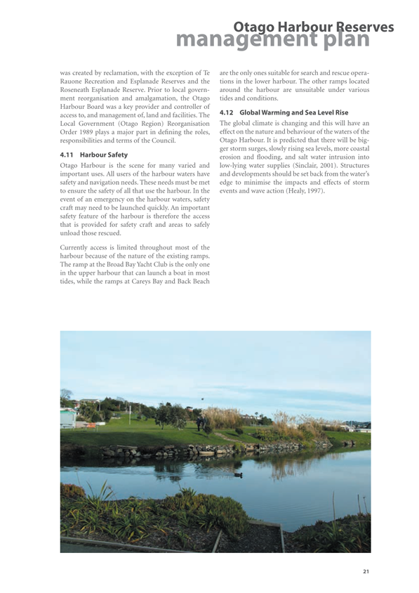
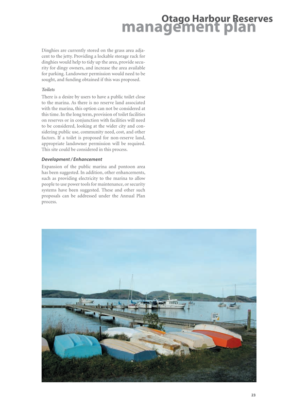
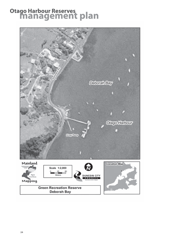
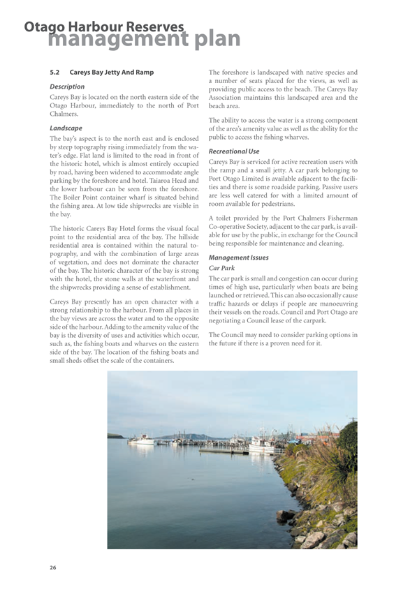
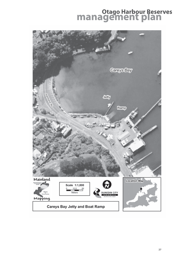
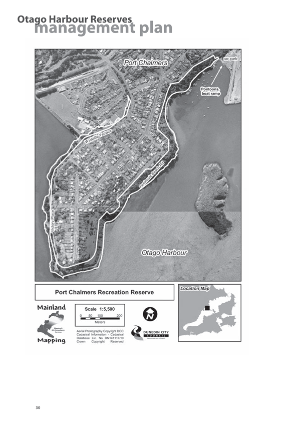
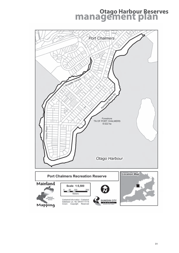
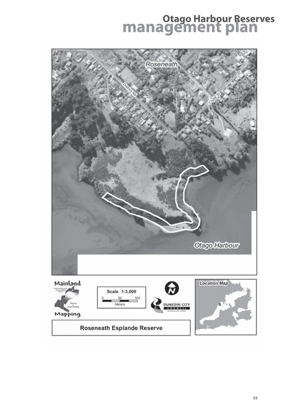
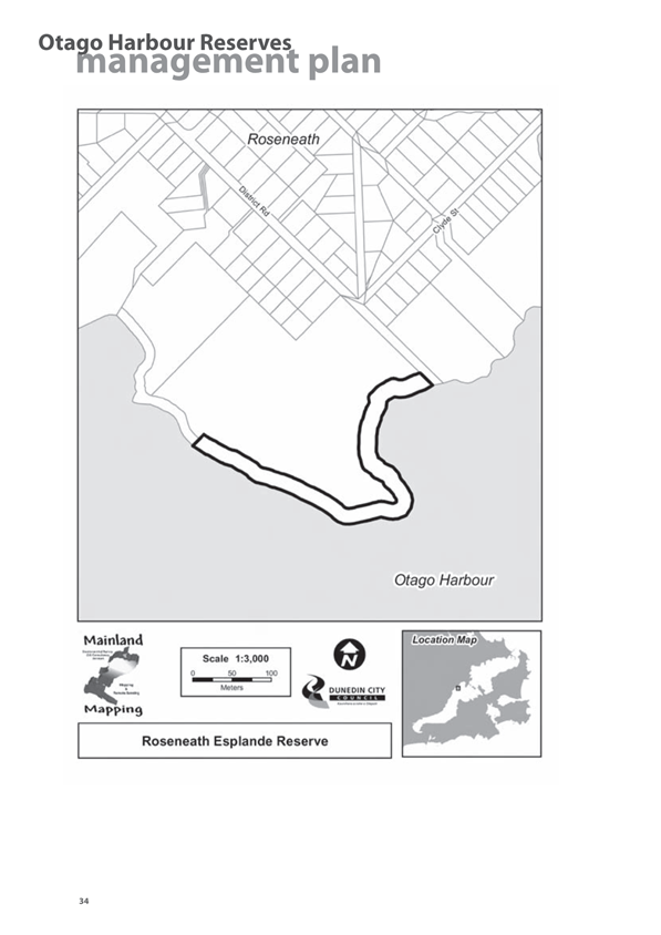
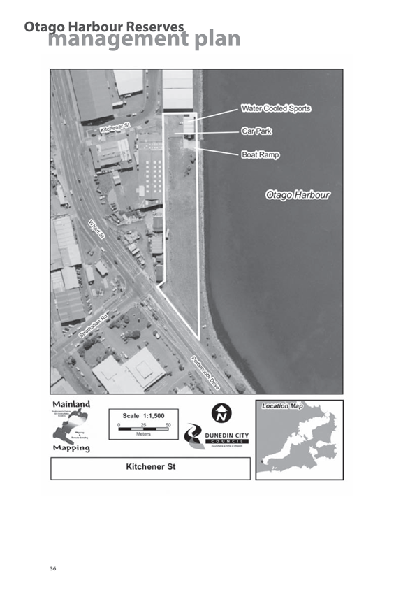
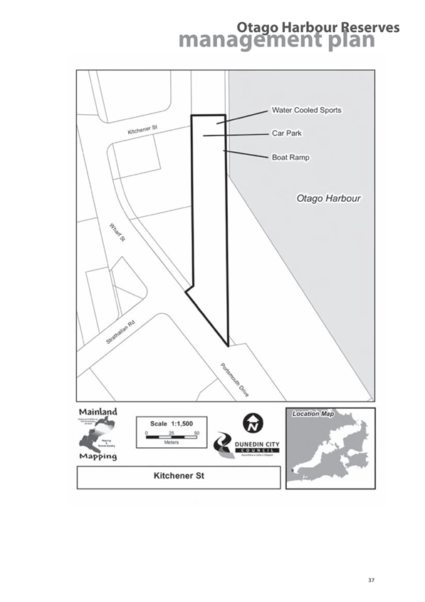
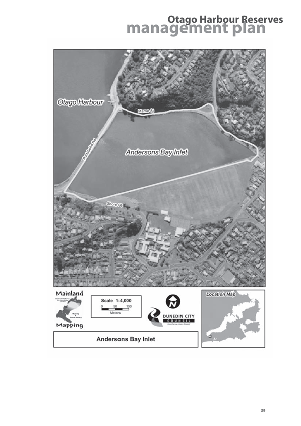
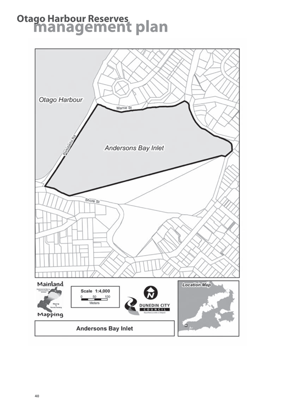
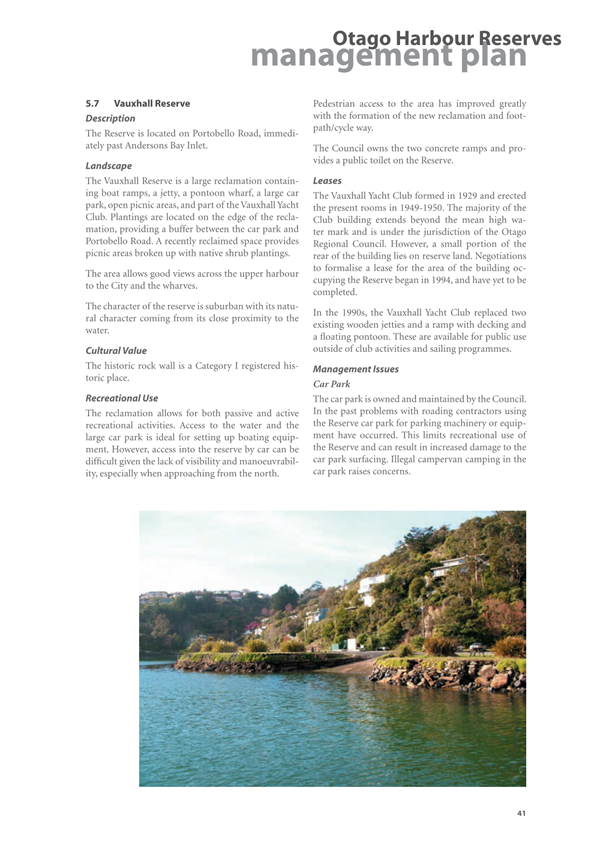
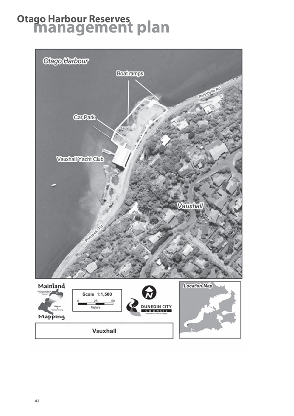
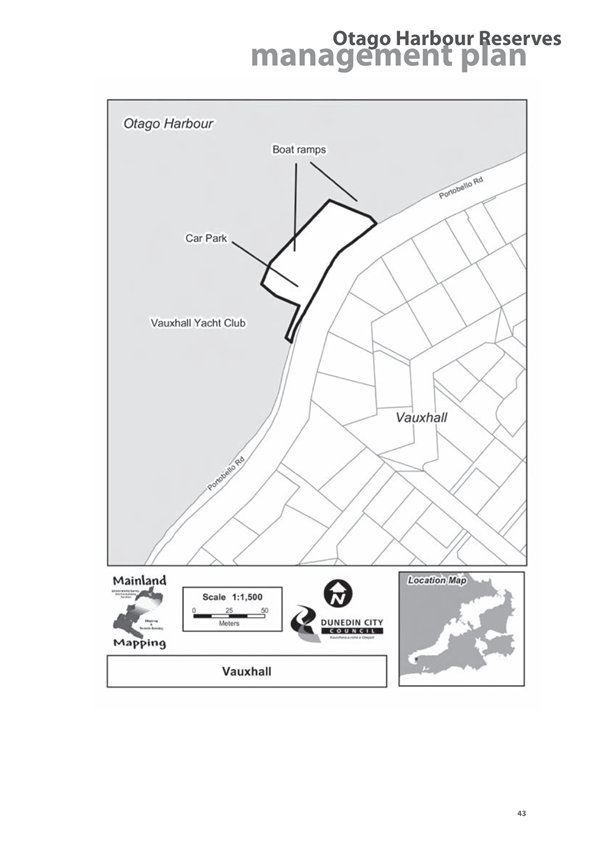
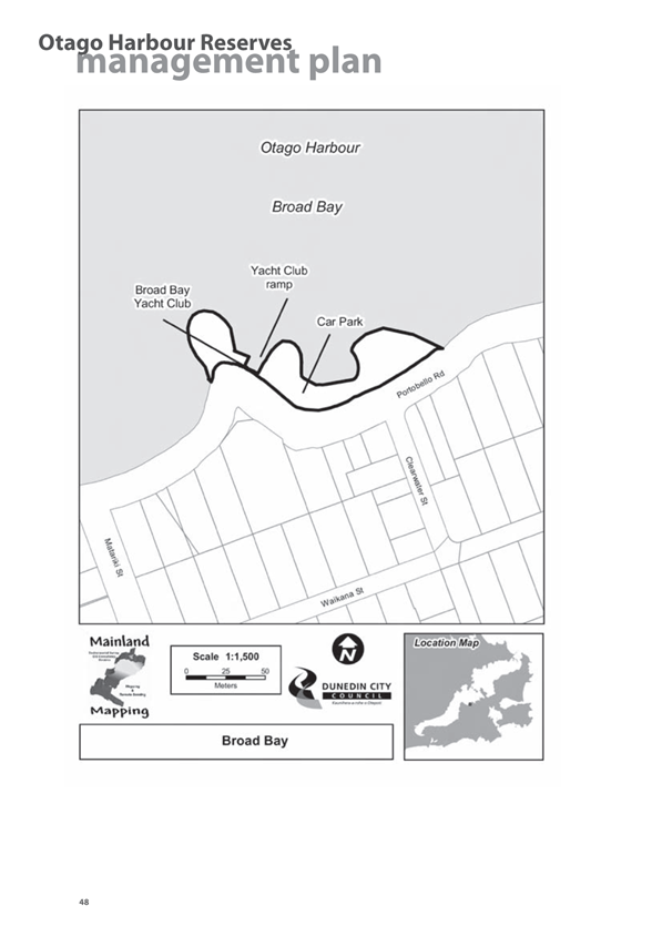
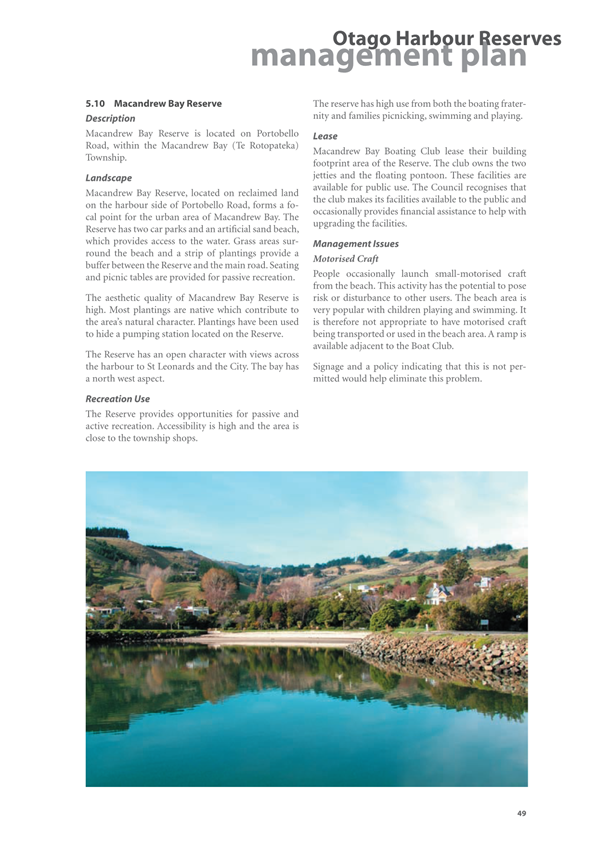
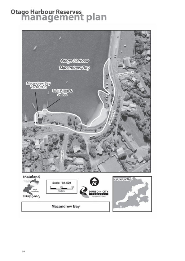
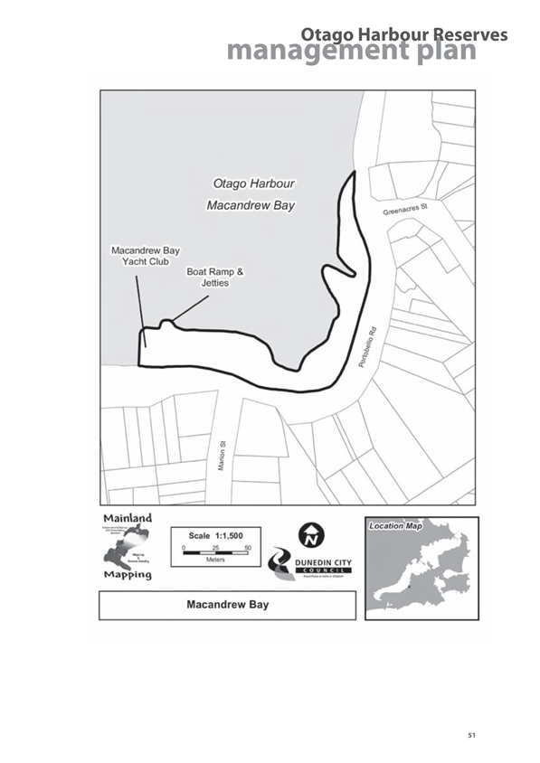
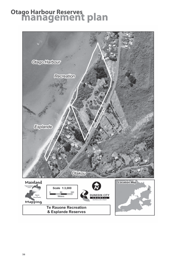
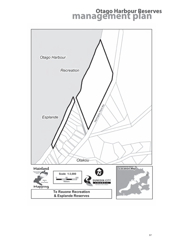
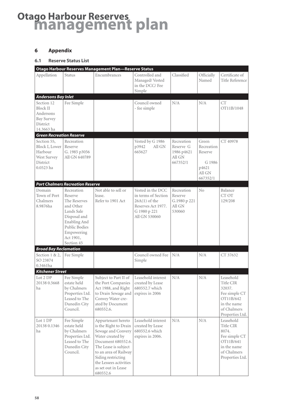
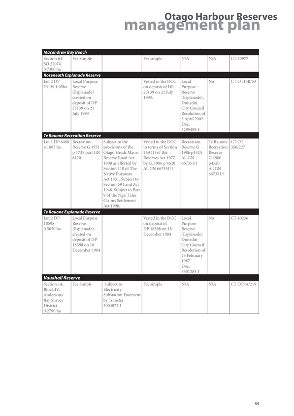
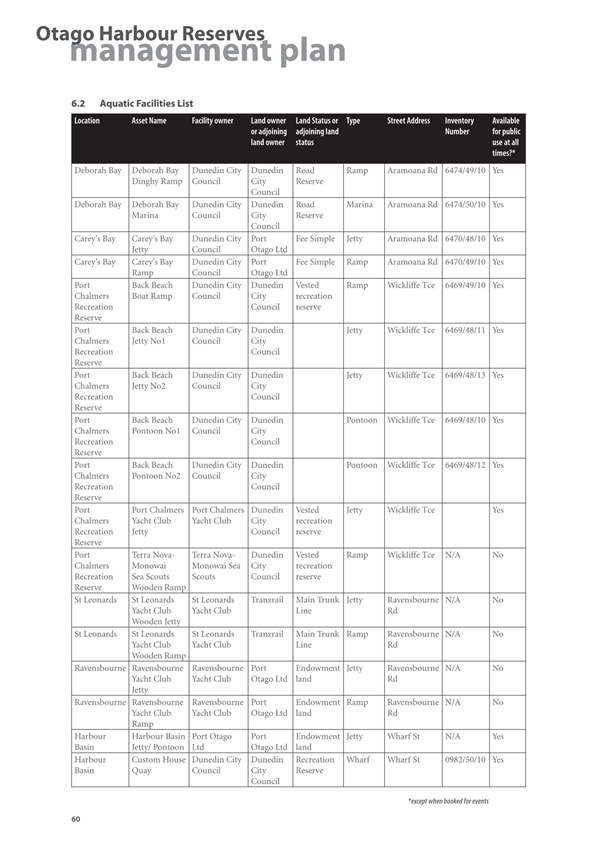
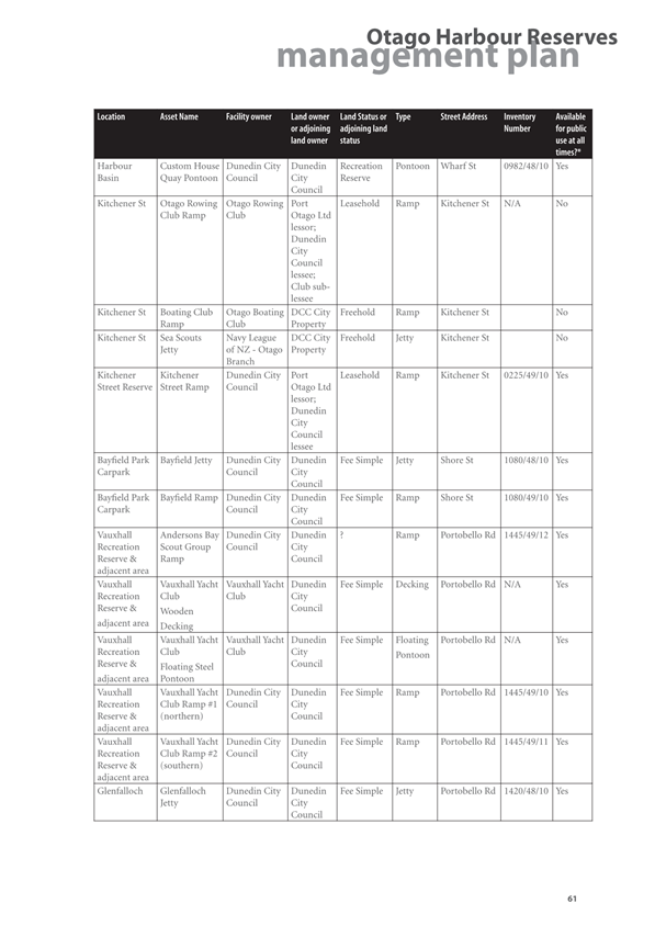
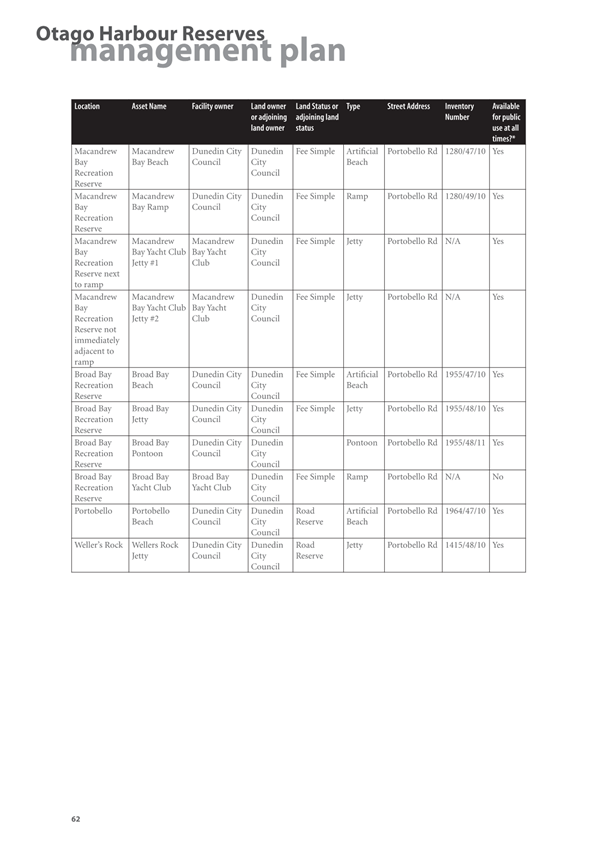
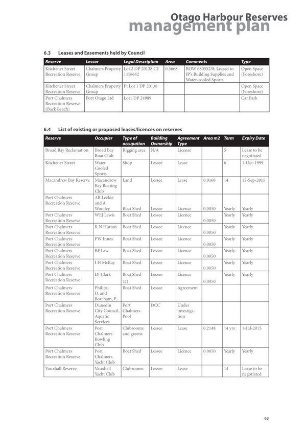
|

|
Strategy, Planning & Engagement
Committee
20 August 2024
|
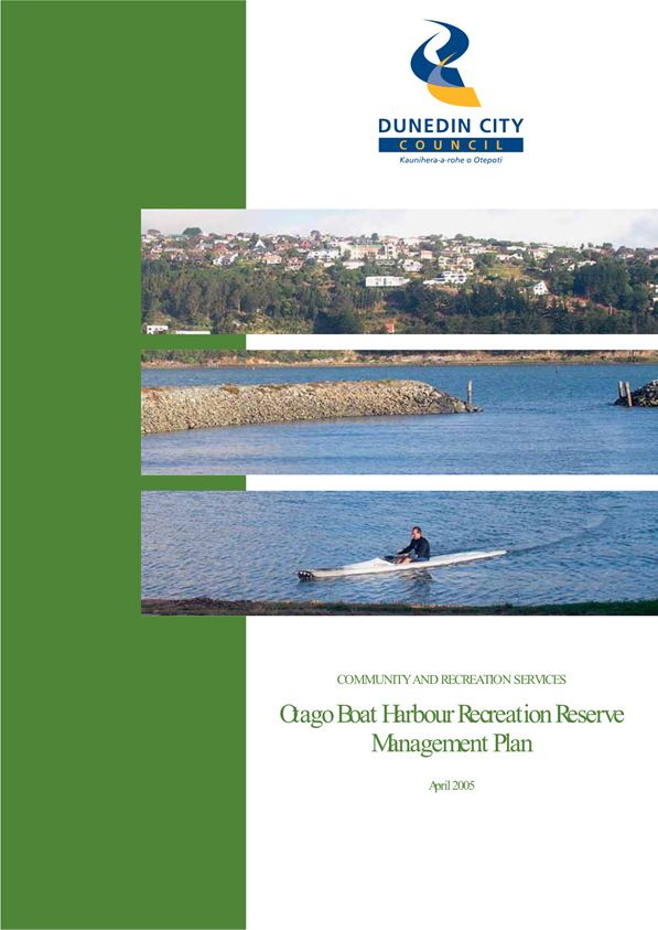
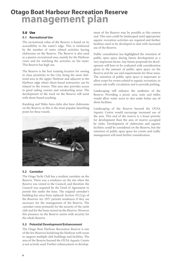
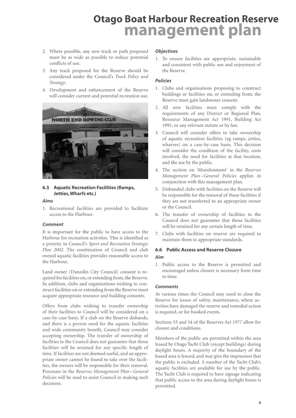
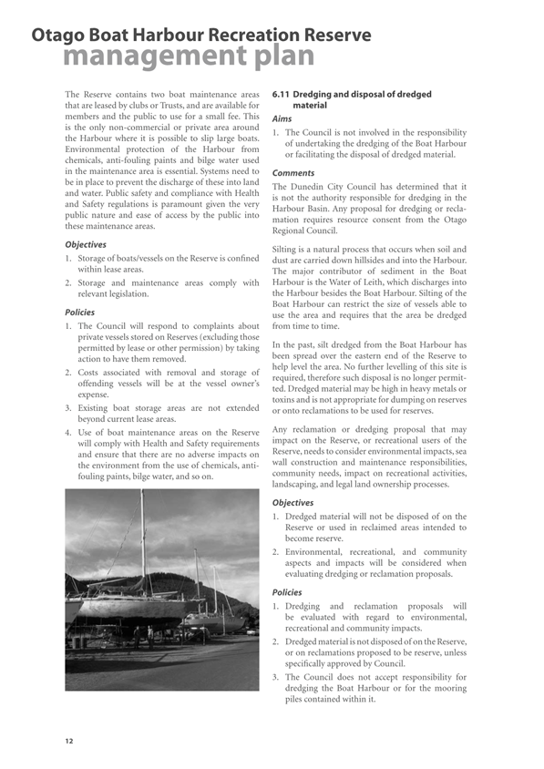
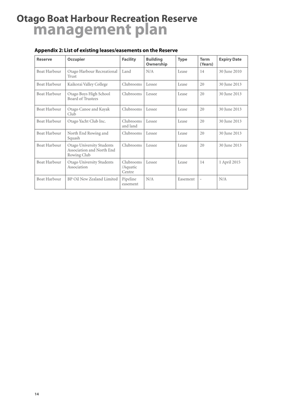
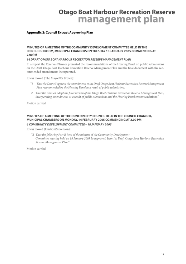
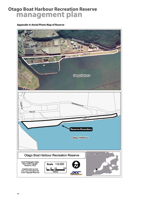
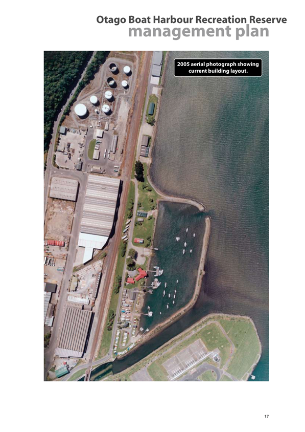
|

|
Strategy, Planning & Engagement
Committee
20 August 2024
|
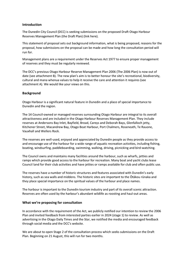
|

|
Strategy, Planning & Engagement
Committee
20 August 2024
|
|

|
Strategy, Planning & Engagement
Committee
20 August 2024
|
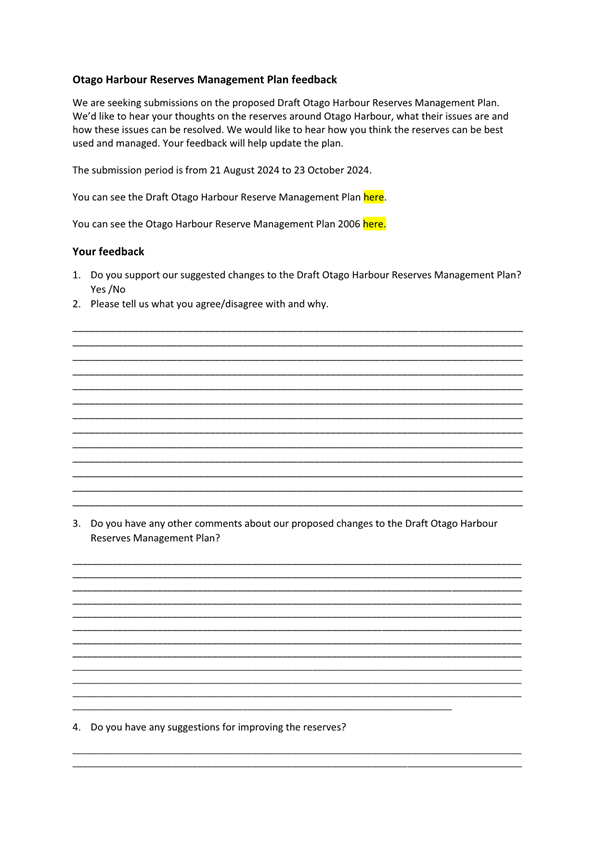
|

|
Strategy, Planning & Engagement
Committee
20 August 2024
|
Items for Consideration by the Chair
Any items for
consideration by the Chair.
Attachments
There are no attachments for this report.


